Inventory of Historic Maps of Mississippi,
created 2007-2017,
by Paul Davis
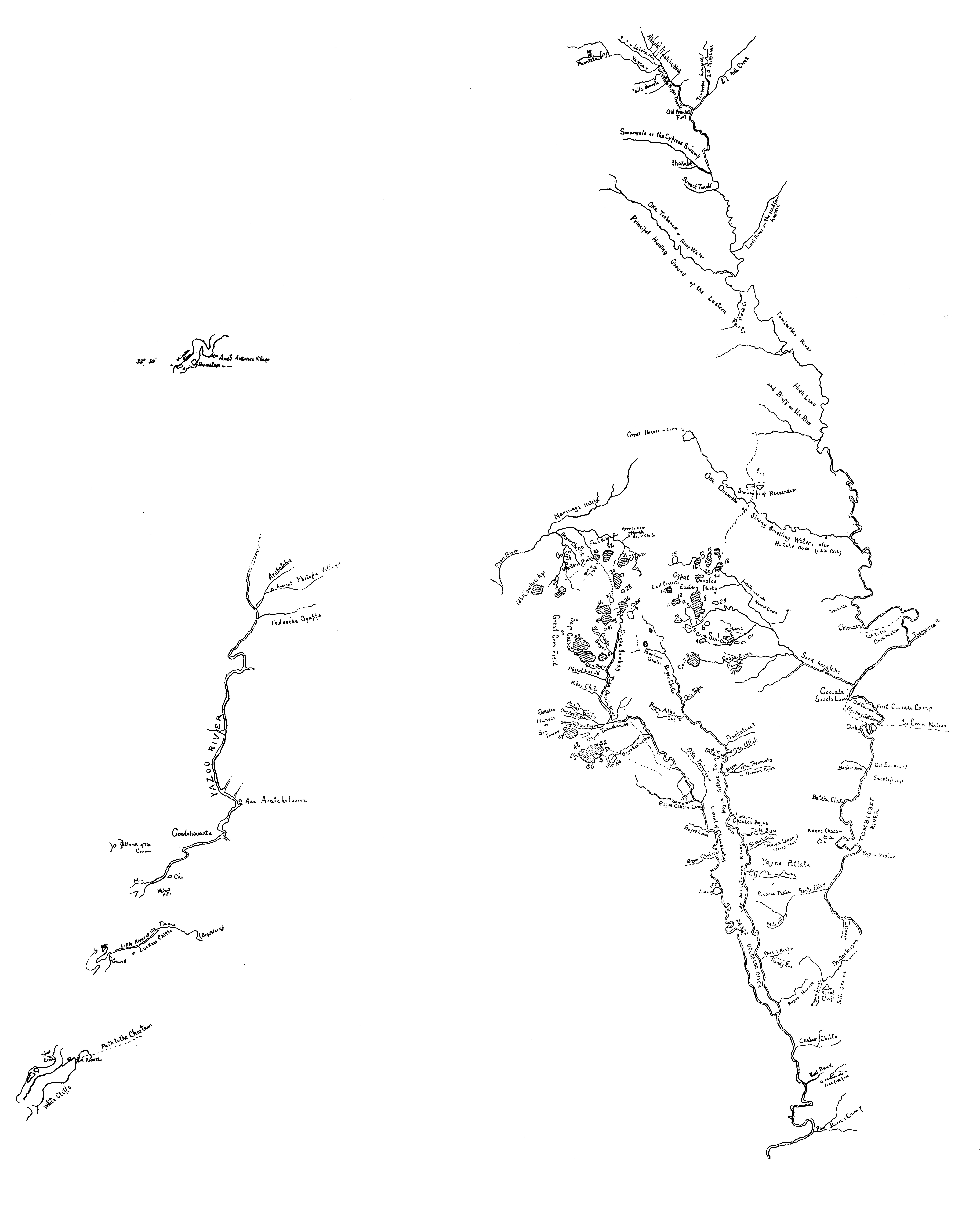
| Title: | A new map of West Florida including the Choctaw, Chickasaw, and upper Creek nations, with a large part of the Spanish dominioms west of the Mississippi, and a part of East Florida, / from different actual surveys, and the best other authorities by Bernard Romans. |
| Author: | Romans, Bernard, ca. 1720-ca. 1784. |
| Situation Date: | 1773 |
| Type: | Photocopy |
| Features: | Drainage, numbered legend noting 60 named Choctaw Indian settlements, 15 unnumbered Chickasaw communities, hunting paths, other paths, remarks on treaties, boundaries, and physical and cultural geography. |
| Comments: | Bibliographic Note: See- Halbert, Henry S. 1902: Bernard Romans' Map of 1772. Publications of the Mississippi Historical Society, vol. 6, pp. 414-439. Features Note: Includes historical text and index. "No. 1294." "Observations made by [?] Roberts of the British Navy..." Coverage Note: Detailed Indian settlement, roads/paths and drainage. Repository Note: National Archives retains a [1780?] manuscript version. Link Note: Link provided includes a more modern version of the detailed area of the state. |
| Coverage: | Kemper, Lauderdale, Neshoba, Newton, Clarke and Wayne Counties |
| Repository: | Mississippi Department of Archives and History | National Archives and Records Administration, Cartographic and Architectural Records |
| Language: | English |
| Size (inches): | 37 X 27.5 |
| Link: | http://rla.unc.edu/Mapfiles/Misc/Romans%201772.Gatschet.clea n.jpg |