Inventory of Historic Maps of Mississippi,
created 2007-2017,
by Paul Davis
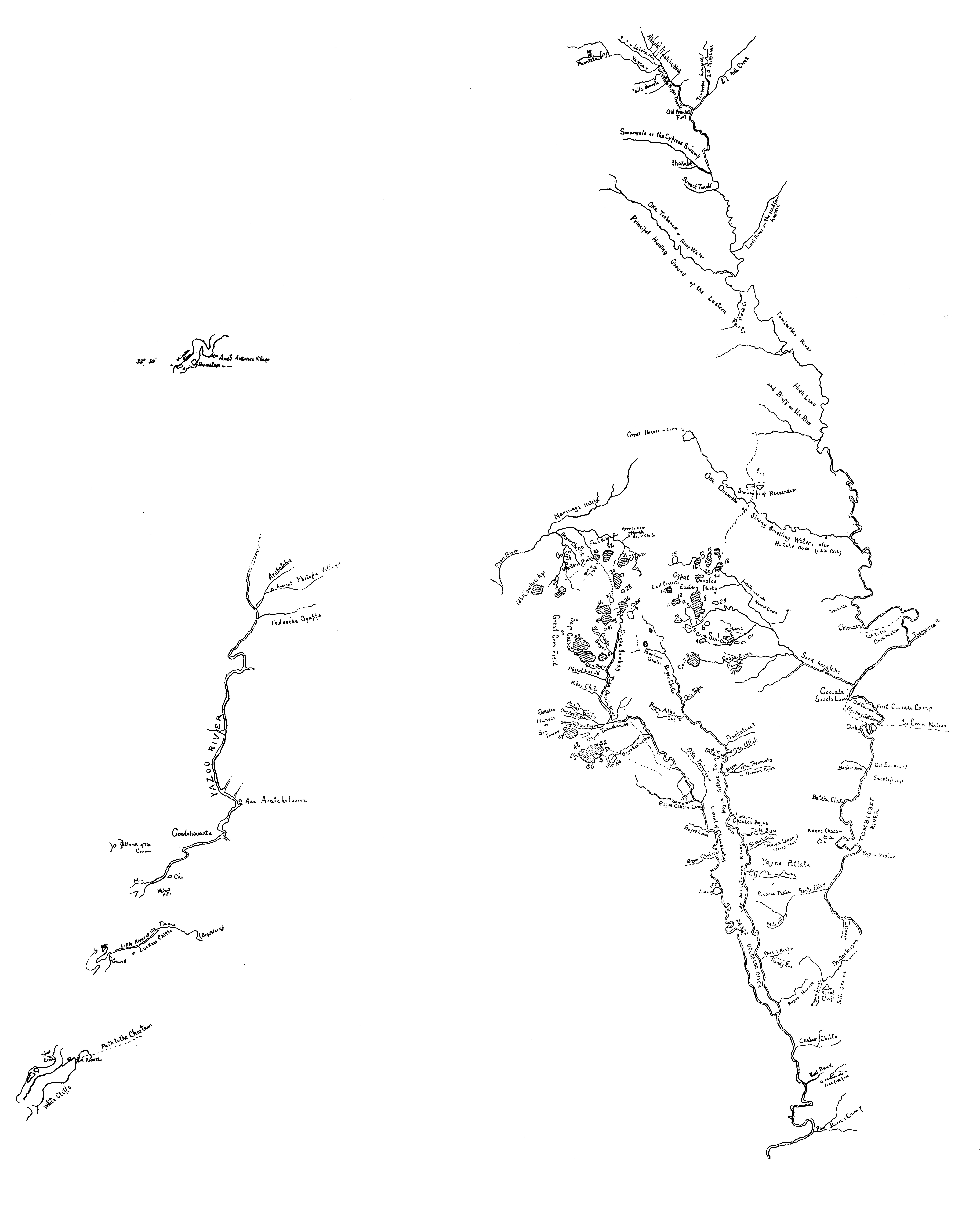
| Title: | Roman’s map of Choctaws of East Mississippi. |
| Author: | Romans, Bernard, ca. 1720-ca.1784. |
| Scale: | 1 inch to 24 miles |
| Situation Date: | ca 1771 |
| Type: | Printed facsimile |
| Features: | Drainage-named, index of sixty Indian settlements located on the map, "Great beaver dam", "Swamps of beaver dam", trails. |
| Comments: | Type Note:Facsimile represents a portion of map from: Bernard Romans. A concise natural history of East and West Florida,... New York, 1775. Features note: Linked image illustrates detailed drainage-named, some references to natural geography. Link Note: Link provided illustrates a modern representation of the original Romans map with only portions of some roads. For an image of the same map with modern counties overlaid see: http://rla.unc.edu/Mapfiles/Misc/Romans%201772.Gatschet.jpg An image of the manuscript map can be seen at: http://dlgcsm.galib.uga.edu/StyleServer/calcrgn?browser=ns&cat=hmap&wid=1000&hei=800&style=hmap/hmap.xsl&item=hmap1733s8.sid |
| Coverage: | Kemper, Lauderdale, Neshoba, Newton, Clarke and Wayne Counties |
| Repository: | Mississippi Department of Archives and History |
| Language: | English |
| Size (inches): | 5.1 X 3.3 |
| Link: | http://rla.unc.edu/Mapfiles/Misc/Romans%201772.Gatschet.clea n.jpg |