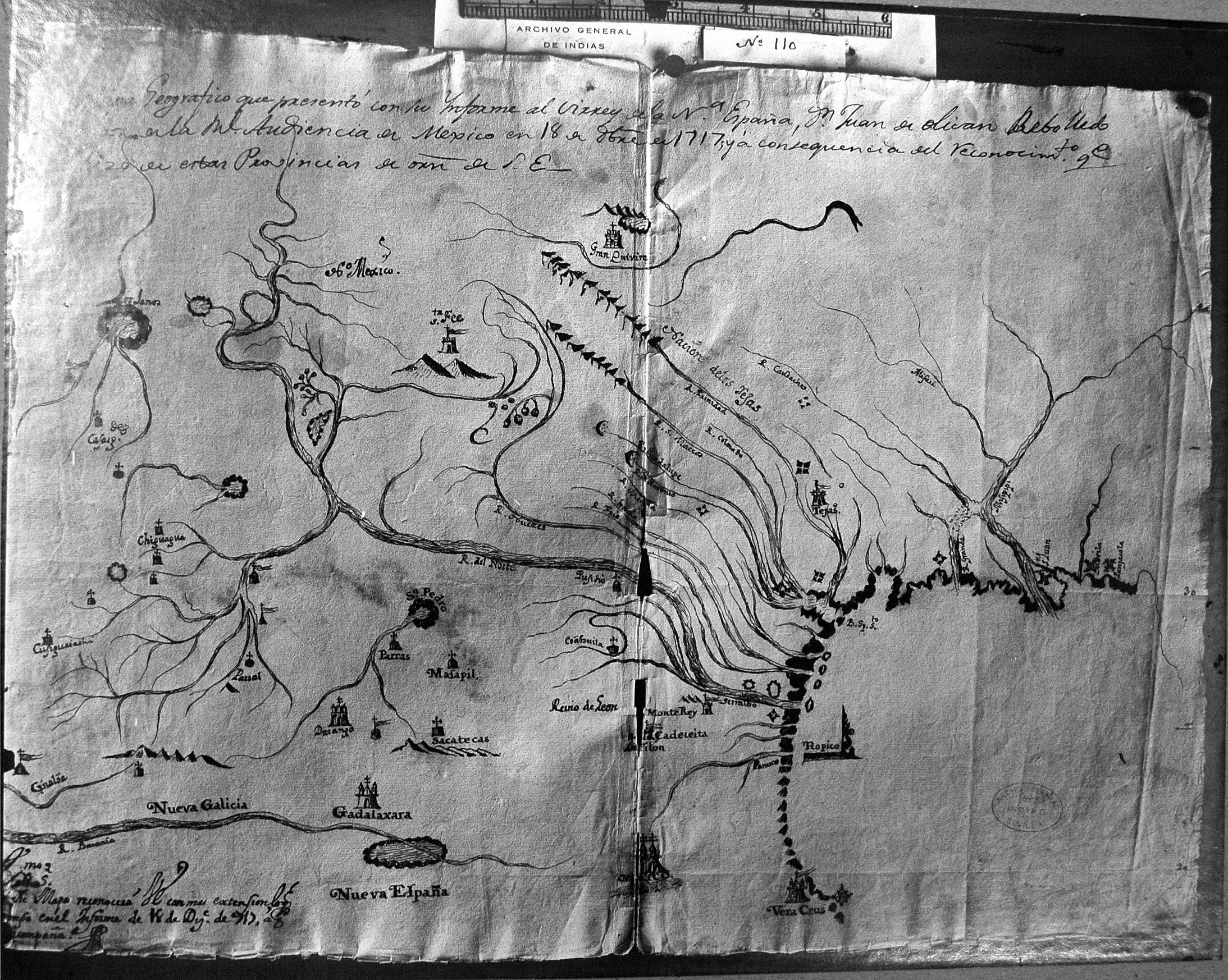
| Title: | [Mapa geografico que presentó con su informe al virrey de la Nueva España, Don Juan de Olivan Rebolledo oydor de la real audiencia de Mexico en 18 de Diciembre de 1717 y á consecuencia del reconocimiento que hizo de estas provincias de orden de S.E.] |
| Author: | Olivan, Rebolledo Juan Manuel de (d. 1738) |
| Situation Date: | 1717 |
| Type: | Photostat |
| Features: | Relief, drainage, possible Indian settlements, Spanish settlements, forts. |
| Comments: | Title Note: General translation-Geographical map submitted with his report to the viceroy of New Spain, Don Juan Rebolledo oydor Olivan of the Royal Audience of Mexico on December 18, 1717 and in consequence of the recognition that made these provinces SE Order |
| Coverage: | Mississippi, Louisiana and Texas |
| Repository: | Newberry Library |
| Language: | Spanish |
| Link: | http://rla.unc.edu/Mapfiles/HMC3/AGI%2061-6-35.HMC.3.jpg |