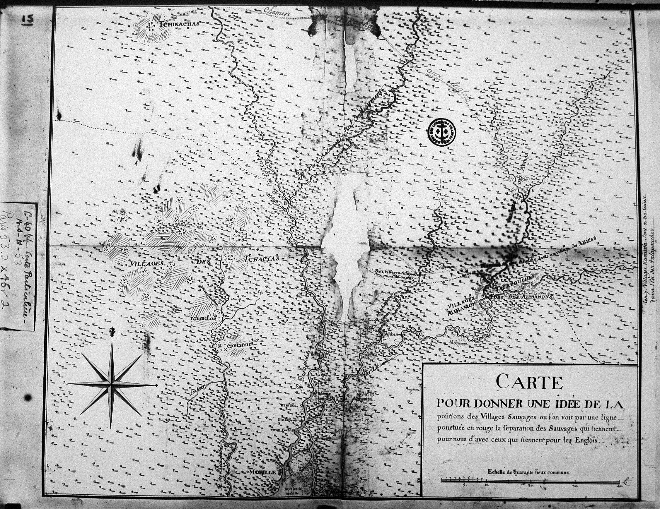
| Title: | Carte pour donner une idée de la position des villages sauvages ou l'on voit par une ligne ponctuée en rouge la séparation des Sauvages qui tiennent pour nous d'avec ceux qui tiennent pour les Englois. |
| Situation Date: | ca 1730 |
| Type: | Photostat |
| Features: | Drainage-many streams named, wooded areas, fields or agricultural/cultivated areas, Indian settlements, trails-purpose defined for some, forts. |
| Comments: | Title Note: General translation-Map to give an idea of the location of communities or wild [Indians] you see a red dotted line in the separation of the Indians take for us to stand with those for Englois [indicating Native American alliance with French or British]. |
| Coverage: | Western Alabama and Eastern Mississippi |
| Repository: | Harvard Map Collection | Newberry Library Karpinski series F 32-3-2. | Service historique de la Défense, département Marine, Cartes et plans |
| Language: | French |
| Link: | http://rla.unc.edu/Mapfiles/HMC3/BSH%20C%204044-53.HMC.3.jpg |