Inventory of Historic Maps of Mississippi,
created 2007-2017,
by Paul Davis
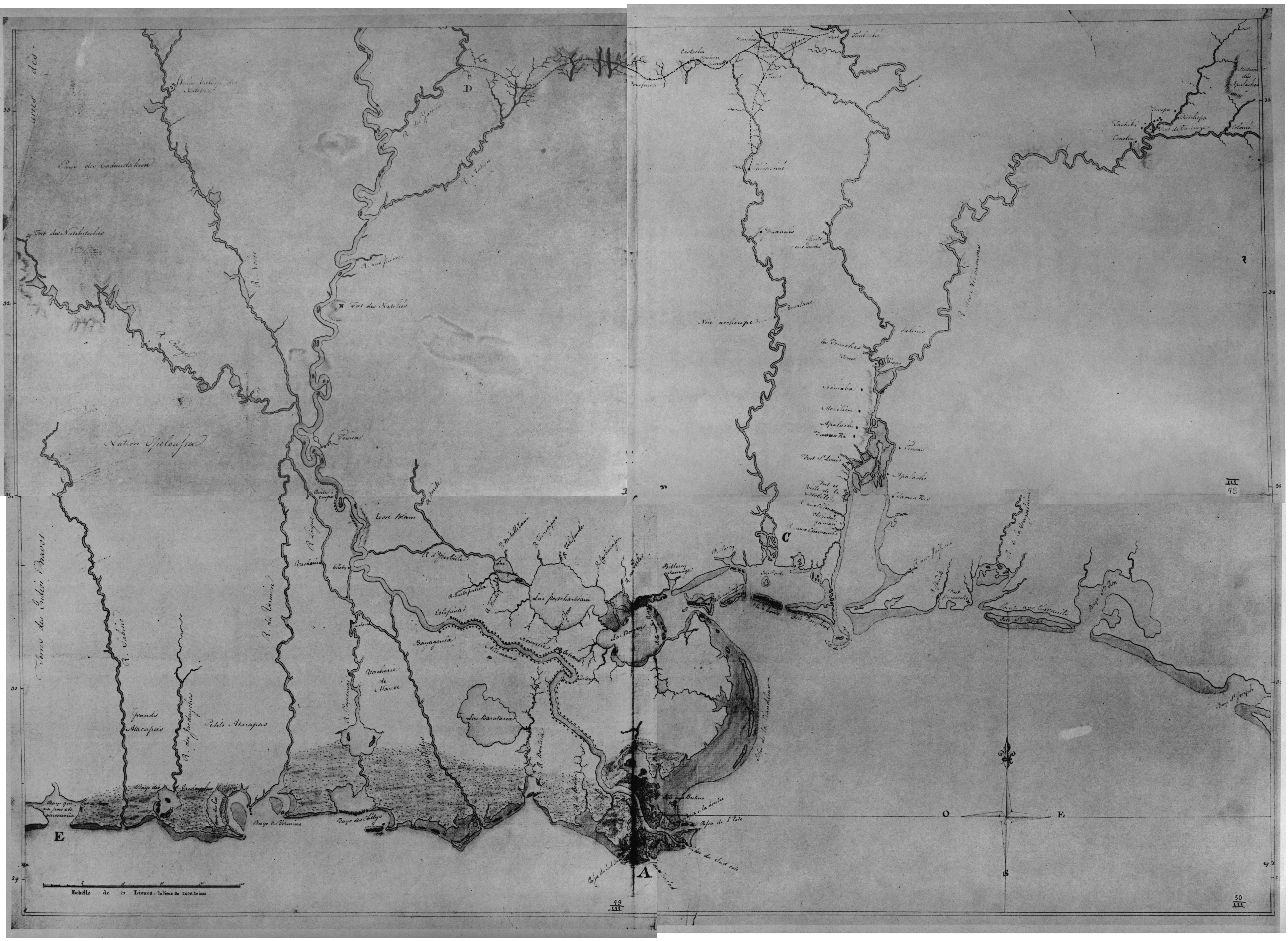
| Title: | [Sketch map (French) of the Delta of the River Mississippi.] |
| Situation Date: | ca 1760 |
| Type: | Manuscript |
| Features: | Drainage, coastal details, lakes, Mississippi River islands, Indian settlements, trails, communities, forts. |
| Comments: | Features Note: Trail system is between the Tombigbee River area and the Yazoo River. |
| Coverage: | South halves of Alabama, Mississippi and Louisiana. |
| Repository: | Public Records Office (UK) |
| Language: | French |
| Link: | http://rla.unc.edu/Mapfiles/CC%28UNC%29/CC3.047-050.jpg |