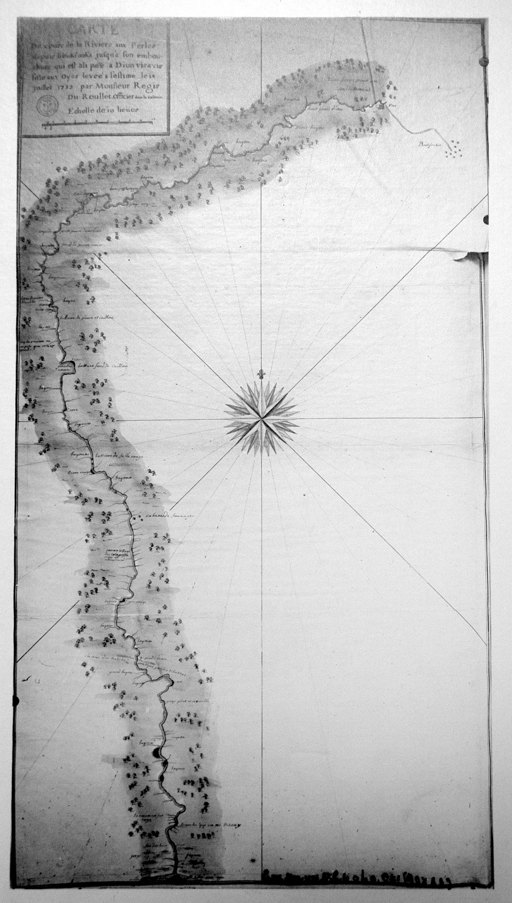
| Title: | Carte du cours de la rivière aux Perles, depuis Boukfouka jusqu'à son embouchure, qui est à la passe a Dion vis a vis l'isle aux Oyes / par M. Régis du Roullet, officier dans la colonie. |
| Author: | Régis du Roullet, Guillaume |
| Situation Date: | 1732 |
| Type: | Manuscript |
| Features: | See Features Notes in Comments section. |
| Comments: | Title Note: General Translation- Map over the Pearl River from Boukfouka to its mouth, which is the passes [that] Dion has overlooked the island to Oyes / Mr Régis du Roullet, an officer in the colony.Features Note: The map illustrates the course of the river in good detail. It also depicts the locations of Indian and perhaps other settlements along the river. Most names unreadable. |
| Coverage: | Mississippi-Simpson, Copiah, Rankin, Hinds, Madison, Leake, Neshoba,Winston counties, and part of Alabama. |
| Repository: | Service historique de la Défense, département Marine, Cartes et plans | Harvard Map Collection. |
| Language: | French |
| Link: | http://rla.unc.edu/Mapfiles/BSH3/BSH%20C%204040-41.HMC.3.jpg |