Inventory of Historic Maps of Mississippi,
created 2007-2017,
by Paul Davis
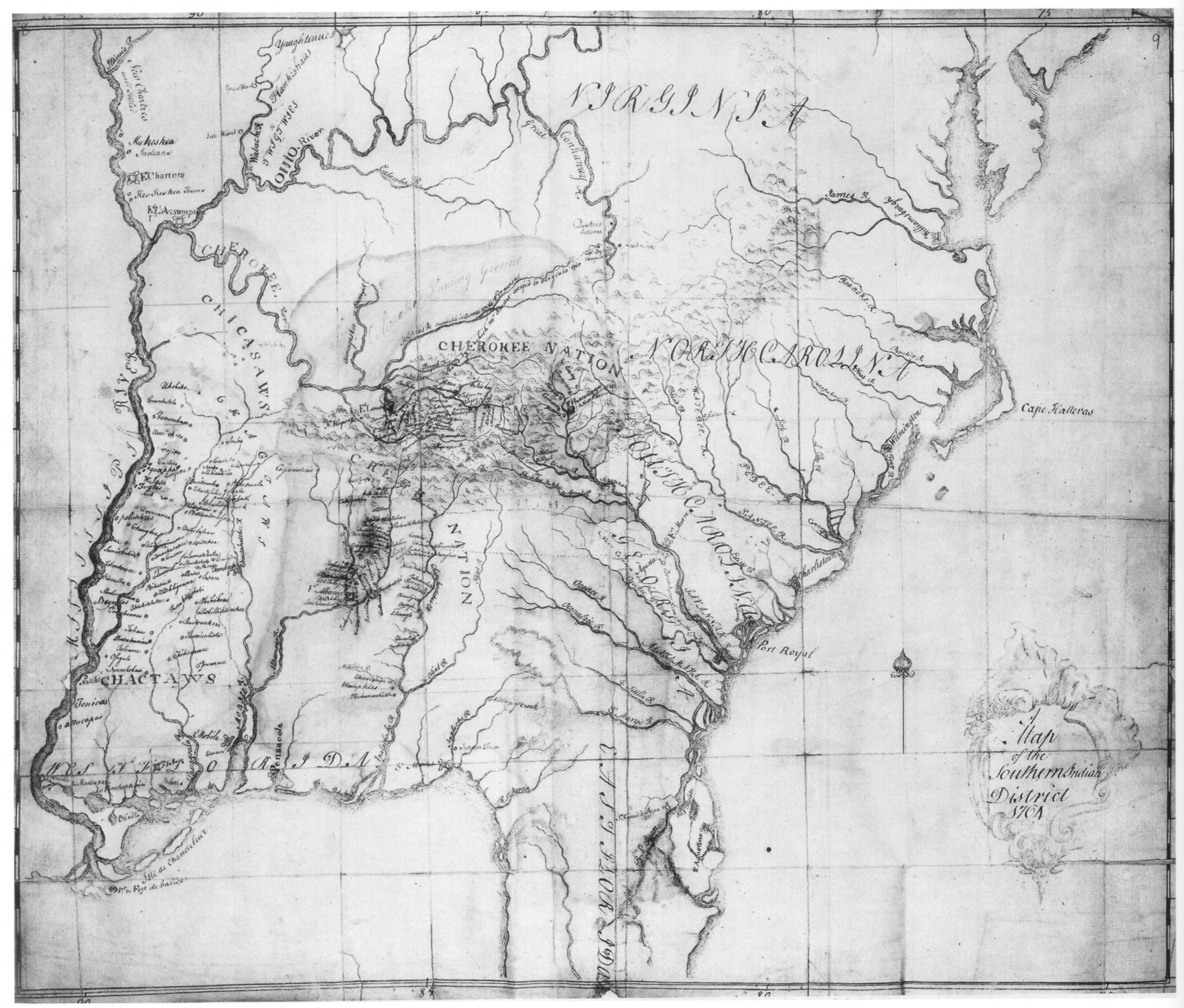
| Title: | A Map of the Southern Indian District 1764. |
| Author: | Stuart, John (1718-1779) |
| Situation Date: | 1764 |
| Type: | Manuscript |
| Features: | Drainage, relief, Indian nations, Indian settlements-named, towns, forts. |
| Comments: | Features Note: Shows the names of many Indian settlements in the areas of Central and Northern Mississippi, Northern Alabama, Northwest Georgia and Eastern Tennessee. Bibliographic Note: In Cumming, William P., 1998: The Southeast in Early Maps. 3rd edition, revised and enlarged by Louis De Vorsey, Jr. University of North Carolina Press, Chapel Hill. Link Note: Other images can be viewed at: http://rla.unc.edu/Mapfiles/CC%28UNC%29/CC1%285%29.41-42.jpg and http://rla.unc.edu/Mapfiles/CC%28LC%29/CC1%285%29.41-42.jpg |
| Coverage: | Eastern U.S. |
| Repository: | British Library |
| Language: | English |
| Link: | http://rla.unc.edu/Mapfiles/SEM/Stuart%201764.BL%28SEM%29.jp g |