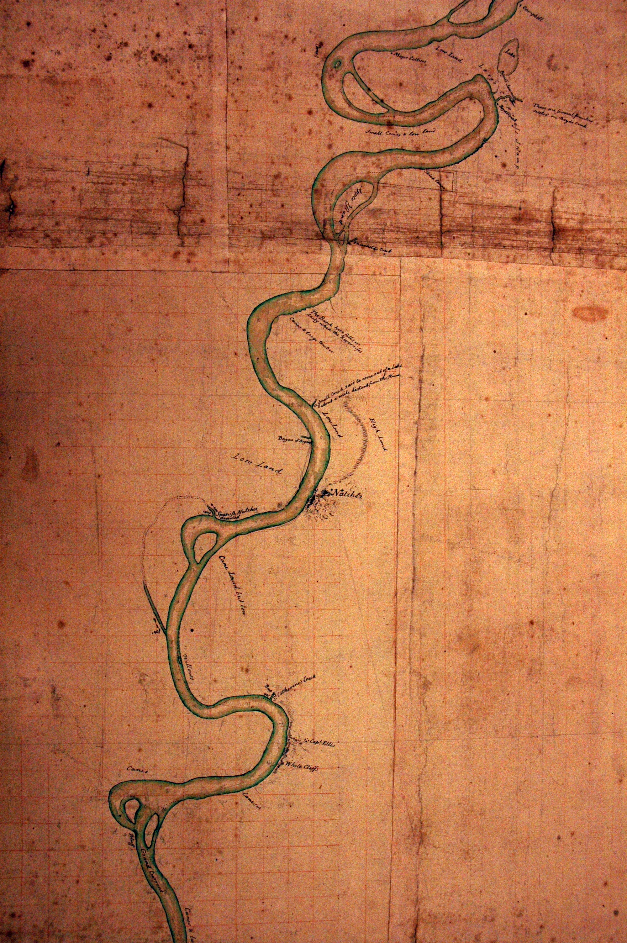
| Title: | [Map of the Mississippi River south from the mouth of the Yazoo River to the southern part of Louisiana.] |
| Situation Date: | 1774 |
| Type: | Manuscript |
| Features: | Mississippi River, river islands, lakes, some natural land features, names of land owners, Natchez. |
| Comments: | Features Note: Contains note on the expedition: The latitudes of the entrance of the river Yazou, Natchez, Manchac, and some other parts of the river were taken by Doctor Lorimer, which were a great correction and satisfaction in laying down this plan. Major Dickson commander of His Majesty's troops in West Florida was the principal promoter of this expedition to the Mississippi. He carried with him Captain Davey of His Majesty's sloop Diligence, Dr. L. and Mr. G. They left Pensacola the 16th February in two open boats, which were hauled over at New Orleans and launched into the Mississippi. They returned by the Iberville through the lakes and arrived at Pensacola the 18th of April 1774, having been absent only two months. |
| Coverage: | Adams, Claiborne, Warren counties. |
| Repository: | Library of Congress |
| Language: | English |
| Color: | Y |
| Link: | http://rla.unc.edu/Mapfiles/LC/G4042.M5.1774.M3.detail1.jpg |