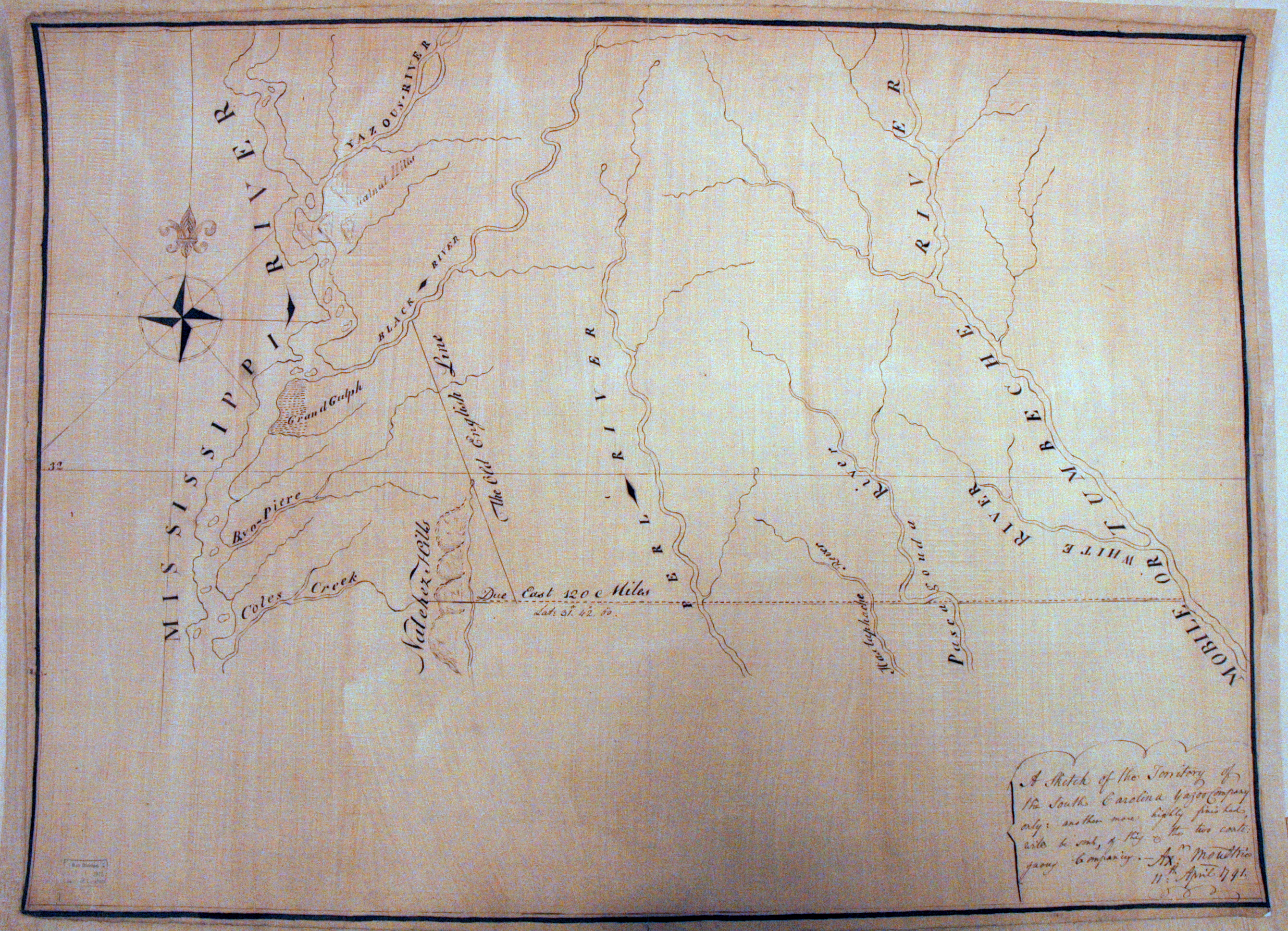
| Title: | A Sketch of the Territory of the South Carolina Yazoo Company |
| Author: | Moultrie, Alexander |
| Situation Date: | 1791 |
| Type: | Manuscript |
| Features: | Drainage, boundary lines, a few place names. |
| Comments: | Features Note: Boundary lines are: "Due east 120 miles" at latitude 31, 42, 00. and "The old English Line" which is a straight line running between the above latitude and the Big Black River. |
| Coverage: | Southern half of the state below the Yazoo River. |
| Repository: | Library of Congress |
| Language: | English |
| Link: | http://rla.unc.edu/Mapfiles/LC/G3980.1791.M.jpg |