Inventory of Historic Maps of Mississippi,
created 2007-2017,
by Paul Davis
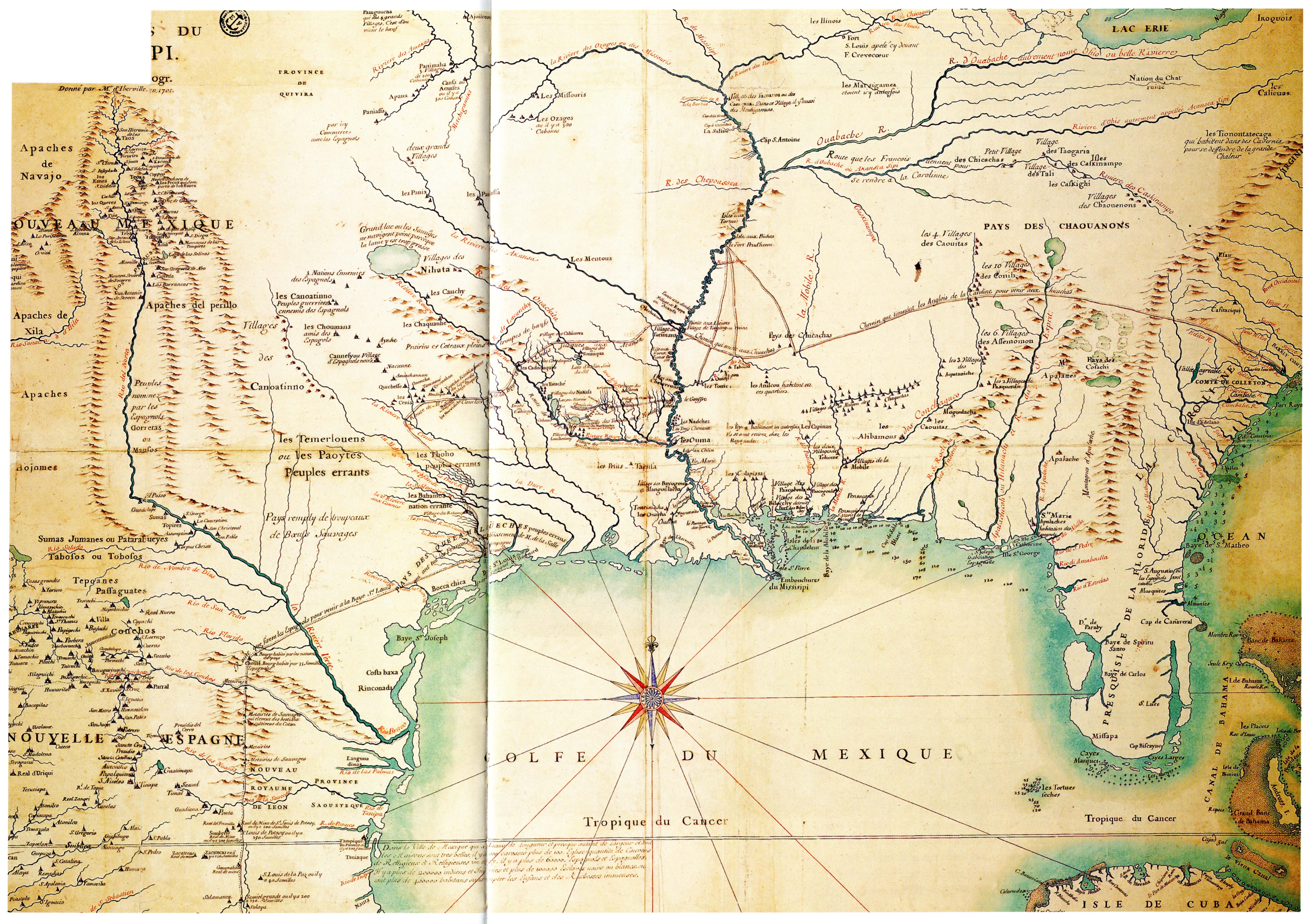
| Title: | Carte des environs du Missisipi par G. de l'Isle géogr. donné par M. d'Iberville en 1701 |
| Author: | L'Isle, Guillaume de, 1675-1726 |
| Situation Date: | 1701 |
| Type: | Photostat |
| Features: | Relief, drainage, lakes, Gulf soundings, Indian nations, Indian settlements-with number of communities in some given areas, towns, communities, trails, forts. |
| Comments: | Title Note: General translation-Map of vicinity of the Mississippi / by G. Isle geogr. given by d'Iberville in 1701 Feature Note: Path noted as: chemin que tiennent les anglois de la caroline pour venir aux- General translation- path of English between Carolina and the Chickasaw. |
| Coverage: | Southeast and Midwest United States. |
| Repository: | Hargrett Rare Book and Manuscript Library, University of Georgia |
| Language: | French |
| Size (inches): | 29.9 X 40.1 |
| Link: | http://dlg.galileo.usg.edu/hmap/id:hmap1701d4 http://rla.unc.edu/Mapfiles/misc/Lisle%201701.Cohen.jpg http://dlgcsm.galib.uga.edu/StyleServer/calcrgn?browser=ns&c at=hmap&wid=1000&hei=800&style=hmap/hmap.xsl&item=hmap1701d4 .sid |