Inventory of Historic Maps of Mississippi,
created 2007-2017,
by Paul Davis
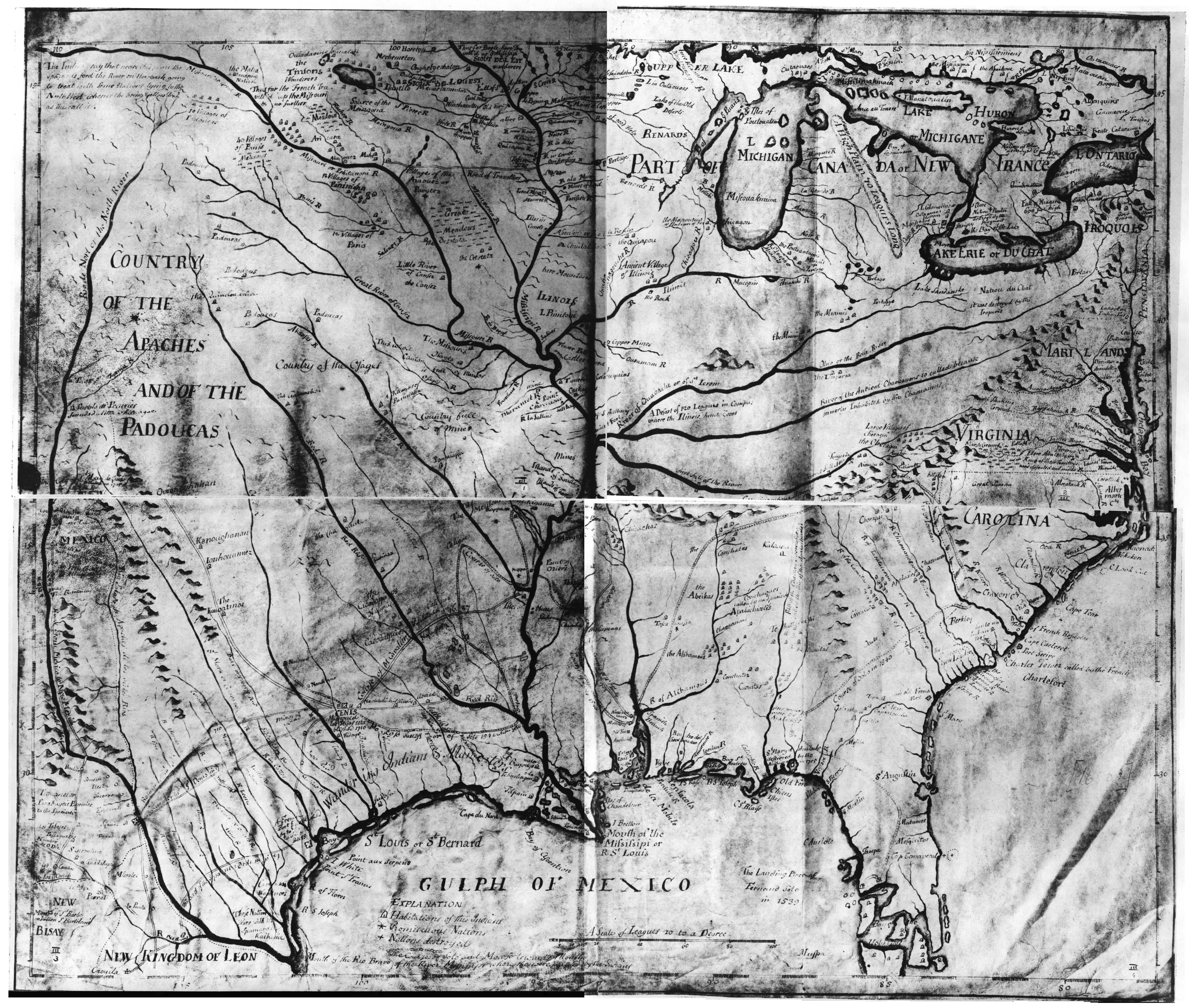
| Title: | [Map of a portion of North America from the Great Lakes to the Gulf of Mexico, and from the River Mississipi to the Atlantic Ocean.] |
| Scale: | ca 1 inch to 75 miles. |
| Situation Date: | ca 1718 |
| Type: | Manuscript |
| Features: | Drainage, relief, Indian nations, Indian settlements, portages, forts- some noted as "old", exploration routes, e.g. De Soto, mines, historical and geographical notes. |
| Coverage: | United States west of Rocky Mountains. |
| Repository: | United Kingdom Public Records Office (PRO) |
| Language: | English |
| Link: | http://rla.unc.edu/Mapfiles/CC%28UNC%29/CC3.001-004.jpg |