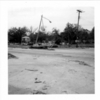
Hurricane Camille Photograph Collection PI/NA/H43.6
Camille, a category 5 hurricane, made landfall on the Gulf Coast just east of Bay St. Louis, Mississippi, around midnight on August 17, 1969, with winds estimated at 200 miles per hour and tides fifteen to thirty-two feet above normal. As it moved through central Kentucky and into West Virginia and Virginia, it dumped up to thirty-one inches of rain, generating flash floods and landslides. The storm system caused an estimated 259 deaths (three in Cuba, 143 on the Gulf Coast, and 113 in the Virginia floods) and $1.421 billion in damage. Until hurricanes Andrew (1992) and Katrina (2005), Camille was cited as the largest single act of destruction in United States history.
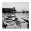
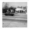
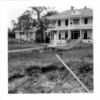
The Hurricane Camille Photograph Collection consists of seventy-three images related to the aftermath of the storm on the Mississippi Gulf Coast. The images were combined from three sources. The United States Air Force produced the first eight (black-and-white) photographs that document Keesler Air Force Base personnel involved in the recovery efforts post-landfall. Al Fred Daniel, a professional photographer from Jackson, Mississippi, created twenty-three black-and-white images of commercial and residential property damage. The largest piece of the collection consists of forty-two color photographs taken by John W. Nicholson Jr., also from Jackson, who captured images of the destruction, especially to churches, along most of the Gulf Coast, including Biloxi, Mississippi City, Gulfport, Long Beach, Pass Christian, and Bay St. Louis, Mississippi.
Read MoreCamille, a category 5 hurricane, made landfall on the Gulf Coast just east of Bay St. Louis, Mississippi, around midnight on August 17, 1969, with winds estimated at 200 miles per hour and tides fifteen to thirty-two feet above normal. As it moved through central Kentucky and into West Virginia and Virginia, it dumped up to thirty-one inches of rain, generating flash floods and landslides. The storm system caused an estimated 259 deaths (three in Cuba, 143 on the Gulf Coast, and 113 in the Virginia floods) and $1.421 billion in damage. Until hurricanes Andrew (1992) and Katrina (2005), Camille was cited as the largest single act of destruction in United States history.
The Hurricane Camille Photograph Collection consists of seventy-three images related to the aftermath of the storm on the Mississippi Gulf Coast. The images were combined from three sources. The United States Air Force produced the first eight (black-and-white) photographs that document Keesler Air Force Base personnel involved in the recovery efforts post-landfall. Al Fred Daniel, a professional photographer from Jackson, Mississippi, created twenty-three black-and-white images of commercial and residential property damage. The largest piece of the collection consists of forty-two color photographs taken by John W. Nicholson Jr., also from Jackson, who captured images of the destruction, especially to churches, along most of the Gulf Coast, including Biloxi, Mississippi City, Gulfport, Long Beach, Pass Christian, and Bay St. Louis, Mississippi.


