Historical Maps
The Mississippi Department of Archives and History has cataloged over 2,500 maps in its "published information" collection. They include hand-drawn sketches of towns, localities, plantations, and battlefields, as well as published maps from the sixteenth through twenty-first centuries.
MDAH staff digitized over 600 paper maps for this online exhibit. The earliest is a triptych printed by the famous Dutch cartographer Abraham Ortelius in 1588, including La Florida, drawn by Geronimo Chaves. In his book The Southeast in Early Maps, William P. Cumming called La Florida "one of the half-dozen most important mother maps of southeastern North America." Several maps in the exhibit trace the history of Mississippi from early exploration through colonial expansion, the territorial period, and statehood. Others are hand-drawn plans and plats of towns, such as P. A. Van Dorn's original plan for the city of Jackson in 1822.
Many maps can also be found in other MDAH collections, such as government records and personal papers. One such example is included in this exhibit, the colorful map of the town of Washington, Mississippi, hand drawn by B. L. C. Wailes in the town's 1838 Minute Book. Maps that other state government agencies (especially the Mississippi Department of Transportation) have scanned to document work projects and then transferred to MDAH are not included here but can be accessed with other electronic government records.
Read MoreThe Mississippi Department of Archives and History has cataloged over 2,500 maps in its "published information" collection. They include hand-drawn sketches of towns, localities, plantations, and battlefields, as well as published maps from the sixteenth through twenty-first centuries.
MDAH staff digitized over 600 paper maps for this online exhibit. The earliest is a triptych printed by the famous Dutch cartographer Abraham Ortelius in 1588, including La Florida, drawn by Geronimo Chaves. In his book The Southeast in Early Maps, William P. Cumming called La Florida "one of the half-dozen most important mother maps of southeastern North America." Several maps in the exhibit trace the history of Mississippi from early exploration through colonial expansion, the territorial period, and statehood. Others are hand-drawn plans and plats of towns, such as P. A. Van Dorn's original plan for the city of Jackson in 1822.
Many maps can also be found in other MDAH collections, such as government records and personal papers. One such example is included in this exhibit, the colorful map of the town of Washington, Mississippi, hand drawn by B. L. C. Wailes in the town's 1838 Minute Book. Maps that other state government agencies (especially the Mississippi Department of Transportation) have scanned to document work projects and then transferred to MDAH are not included here but can be accessed with other electronic government records.
Refine results
Did you mean pontotoc county 100?
No results matched all of your words. Showing results for any of your words.
-
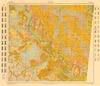
Soil map, Mississippi : Noxubee County sheet
From: Historical Maps
Soil map, Mississippi : Noxubee County sheet / U.S.
Noxubee County
-
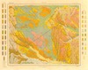
Soil map : Mississippi, Oktibbeha County sheet
From: Historical Maps
Soil map : Mississippi, Oktibbeha County sheet / U.S.
Oktibbeha County
-
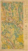
Soil map, Mississippi : Perry County sheet
From: Historical Maps
Soil map, Mississippi : Perry County sheet / U.S.
Perry County
-
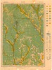
Soil map, Mississippi : Pike County sheet
From: Historical Maps
Soil map, Mississippi : Pike County sheet / U.S.
Pike County
-
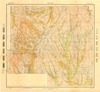
Soil map, Mississippi : Prentiss County sheet
From: Historical Maps
Soil map, Mississippi : Prentiss County sheet / U.S.
Prentiss County
-
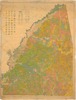
Soil map, Mississippi : Rankin County
From: Historical Maps
Soil map, Mississippi: Rankin County / U.S.
Rankin County
-
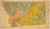
Soil map, Mississippi : Simpson County sheet
From: Historical Maps
Soil map, Mississippi : Simpson County sheet / U.S.
Simpson County
-
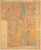
Soil map, Mississippi : Smith County sheet
From: Historical Maps
Soil map, Mississippi : Smith County sheet / U.S.
Smith County
-
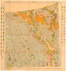
Soil map, Mississippi : Wayne County sheet
From: Historical Maps
Soil map, Mississippi : Wayne County sheet / U.S.
Wayne County
-
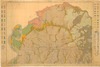
Soil map, Mississippi : Wilkinson County sheet
From: Historical Maps
Soil map, Mississippi : Wilkinson County sheet / U.S.
Wilkinson County
-
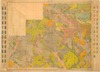
Soil map [Mississippi] : Winston County Sheet
From: Historical Maps
Soil map [Mississippi] : Winston County Sheet / U.S.
Winston County
-
-
-
-
-
-
-
-
-
-
-
-
-
-
-
-
-
-
-
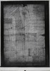
Map of the estate of Tho's H. Buckner, Washington Co., Miss.
From: Historical Maps
Washington County
-
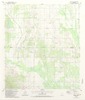
Trebloc quadrangle, Mississippi - 1987 : 7.5 minute series (topographic)
From: Historical Maps
Chickasaw County
-
Vancleave quadrangle, Mississippi - 1941 : 15 minute series (topographic)
From: Historical Maps
Jackson County
-
Vestry quadrangle, Mississippi - 1954 : 15 minute series (topographic)
From: Historical Maps
Jackson County
-
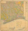
Soil map, Mississippi : Harrison County
From: Historical Maps
Soil map, Mississippi : Harrison County / U.S.
Harrison County
-
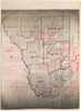
Map of Hancock County, Mississippi
From: Historical Maps
Map of Hancock County, Mississippi / drawn by B.E.
Connell's fishing map of Hancock County, Mississippi.
Hancock County
-
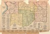
Map of Desoto County, Mississippi
From: Historical Maps
Map of Desoto County, Mississippi / compiled by R. F. B. Logan.
DeSoto County
-
Jefferson County, Mississippi : general highway map
From: Historical Maps
Jefferson County, Mississippi : general highway map / prepared by Mississippi State Highway Department
Jefferson County
-
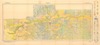
Soil map, Mississippi: Grenada County sheet
From: Historical Maps
Soil map, Mississippi: Grenada County sheet / U.S.
Grenada County
-
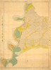
Soil map, Mississippi, Adams County sheet
From: Historical Maps
Soil map, Mississippi, Adams County sheet / U.S.
Adams County
-
-
-
-
-

-

-
-
-
-
-