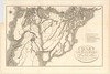
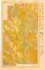
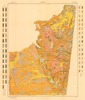
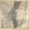
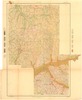
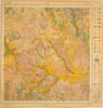
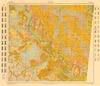
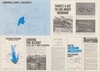
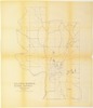
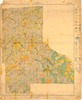
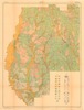
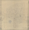
Historical Maps
The Mississippi Department of Archives and History has cataloged over 2,500 maps in its "published information" collection. They include hand-drawn sketches of towns, localities, plantations, and battlefields, as well as published maps from the sixteenth through twenty-first centuries.
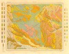
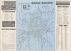
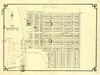
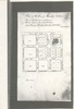
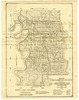
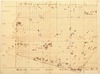
MDAH staff digitized over 600 paper maps for this online exhibit. The earliest is a triptych printed by the famous Dutch cartographer Abraham Ortelius in 1588, including La Florida, drawn by Geronimo Chaves. In his book The Southeast in Early Maps, William P. Cumming called La Florida "one of the half-dozen most important mother maps of southeastern North America." Several maps in the exhibit trace the history of Mississippi from early exploration through colonial expansion, the territorial period, and statehood. Others are hand-drawn plans and plats of towns, such as P. A. Van Dorn's original plan for the city of Jackson in 1822.
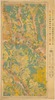
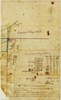
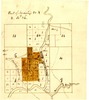
Many maps can also be found in other MDAH collections, such as government records and personal papers. One such example is included in this exhibit, the colorful map of the town of Washington, Mississippi, hand drawn by B. L. C. Wailes in the town's 1838 Minute Book. Maps that other state government agencies (especially the Mississippi Department of Transportation) have scanned to document work projects and then transferred to MDAH are not included here but can be accessed with other electronic government records.
Read MoreThe Mississippi Department of Archives and History has cataloged over 2,500 maps in its "published information" collection. They include hand-drawn sketches of towns, localities, plantations, and battlefields, as well as published maps from the sixteenth through twenty-first centuries.
MDAH staff digitized over 600 paper maps for this online exhibit. The earliest is a triptych printed by the famous Dutch cartographer Abraham Ortelius in 1588, including La Florida, drawn by Geronimo Chaves. In his book The Southeast in Early Maps, William P. Cumming called La Florida "one of the half-dozen most important mother maps of southeastern North America." Several maps in the exhibit trace the history of Mississippi from early exploration through colonial expansion, the territorial period, and statehood. Others are hand-drawn plans and plats of towns, such as P. A. Van Dorn's original plan for the city of Jackson in 1822.
Many maps can also be found in other MDAH collections, such as government records and personal papers. One such example is included in this exhibit, the colorful map of the town of Washington, Mississippi, hand drawn by B. L. C. Wailes in the town's 1838 Minute Book. Maps that other state government agencies (especially the Mississippi Department of Transportation) have scanned to document work projects and then transferred to MDAH are not included here but can be accessed with other electronic government records.
You may try wrapping a query in double quotes for more specific results (e.g. "yazoo county").
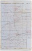
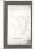
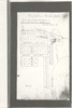
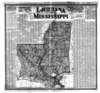
Showing results 101-150 of 318 for yazoo county
-
85738-1-map.tif
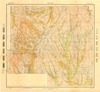
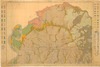
Soil map, Mississippi : Lee County sheet / U.S.
Lee County
https://da.mdah.ms.gov/series/maps/detail/191654
-
85739-1-map.tif
Soil map, Mississippi : Lincoln County sheet / U.S.
Lincoln County
https://da.mdah.ms.gov/series/maps/detail/191655
-
85741-1-map.tif
Soil map, Mississippi : Lowndes County sheet / U.S.
Lowndes County
https://da.mdah.ms.gov/series/maps/detail/191656
-
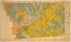
85839-1-map.tif
Soil map : Mississippi, Monroe County sheet / U.S.
Monroe County
https://da.mdah.ms.gov/series/maps/detail/191658
-
85840-1-map.tif
Soil map : Mississippi, Montgomery County sheet / U.S.
Montgomery County
https://da.mdah.ms.gov/series/maps/detail/191659
-
85841-1-map.tif
Soil map, Mississippi : Newton County sheet / U.S.
Newton County
https://da.mdah.ms.gov/series/maps/detail/191660
-
85842-1-map.tif
Soil map, Mississippi : Noxubee County sheet / U.S.
Noxubee County
https://da.mdah.ms.gov/series/maps/detail/191661
-
85843-1-map.tif
Soil map : Mississippi, Oktibbeha County sheet / U.S.
Oktibbeha County
https://da.mdah.ms.gov/series/maps/detail/191662
-
85868-1-map.tif
Soil map, Mississippi : Perry County sheet / U.S.
Perry County
https://da.mdah.ms.gov/series/maps/detail/191664
-
85869-1-map.tif
Soil map, Mississippi : Pike County sheet / U.S.
Pike County
https://da.mdah.ms.gov/series/maps/detail/191665
-
85871-1-map.tif
Soil map, Mississippi : Pontotoc County sheet / U.S.
Pontotoc County
https://da.mdah.ms.gov/series/maps/detail/191666
-
85873-1-map.tif
Soil map, Mississippi : Prentiss County sheet / U.S.
Prentiss County
https://da.mdah.ms.gov/series/maps/detail/191667
-
85878-1-map.tif
Soil map, Mississippi : Simpson County sheet / U.S.
Simpson County
https://da.mdah.ms.gov/series/maps/detail/191669
-
85879-1-map.tif
Soil map, Mississippi : Smith County sheet / U.S.
Smith County
https://da.mdah.ms.gov/series/maps/detail/191670
-
85883-1-map.tif
Soil map, Mississippi : Wayne County sheet / U.S.
Wayne County
https://da.mdah.ms.gov/series/maps/detail/191671
-
85884-1-map.tif
Soil map, Mississippi : Wilkinson County sheet / U.S.
Wilkinson County
https://da.mdah.ms.gov/series/maps/detail/191672
-
85885-1-map.tif
Soil map [Mississippi] : Winston County Sheet / U.S.
Winston County
https://da.mdah.ms.gov/series/maps/detail/191673
-
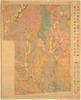
72543-map-01.tif
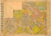
Shows counties, county seats and county railroads
Hammond's County map of Mississippi / prepared especially for the Directory of newspapers and periodicals
https://da.mdah.ms.gov/series/maps/detail/1061883
-
67711_1.tif
Historical Copiah County : charter January 21, 1823 / by Robert W. Bell, Jr.
Copiah County
https://da.mdah.ms.gov/series/maps/detail/191320
-
69640-map-01.tif
Map of Meridian, Mississippi, and Lauderdale County, side 1.
Lauderdale County
https://da.mdah.ms.gov/series/maps/detail/191415
-
69640-map-02.tif
Map of Meridian, Mississippi, and Lauderdale County, side 2.
Lauderdale County
https://da.mdah.ms.gov/series/maps/detail/191416
-
69671-map.tif
Map of Tishomingo City, Tishomingo County, Miss. / Jno. I. Pierce.
Tishomingo County
https://da.mdah.ms.gov/series/maps/detail/191423
-
69730-1-map.tif
Township 15, range 3 east : Warren County.
Warren County
https://da.mdah.ms.gov/series/maps/detail/191462
-
69766-map-01.tif
Columbus Separate School District : Lowndes County, Miss. / D.E. Field, civil engineer
Lowndes County
https://da.mdah.ms.gov/series/maps/detail/191485
-
85683-1-map.tif
Soil map, Mississippi : Jefferson Davis County sheet / U.S.
Jefferson Davis County
https://da.mdah.ms.gov/series/maps/detail/191649
-
85844-1-map.tif
Soil map, Mississippi : Pearl River County sheet / U.S.
Pearl River County
https://da.mdah.ms.gov/series/maps/detail/191663
-
67723-1-map.tif
Choctaw County, Mississippi
Rural delivery routes [map] : Choctaw County, Miss. / United States Post Office Department.
Choctaw County
https://da.mdah.ms.gov/series/maps/detail/897298
-
67720-map-01.tif
Department of Education : Calhoun County, May 19, 1928 / by Q.T. Crowson, Supt. of Ed.
Calhoun County
https://da.mdah.ms.gov/series/maps/detail/191326
-
-
-
-
-
-
-
-
-
72678-map-01.tif
Farm and timber land for sale in the famous Yazoo-Mississippi Delta, Mississippi, U.S.A. / George T.
https://da.mdah.ms.gov/series/maps/detail/191624
-
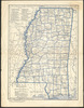
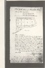
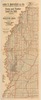
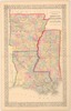
8204-01-c2-map.tif
County map of the states of Arkansas, Mississippi, and Louisiana / drawn and engraved by W. H.
https://da.mdah.ms.gov/series/maps/detail/191134
-
8205-1-map.tif
County map of the states of Arkansas, Mississippi, and Louisiana.
https://da.mdah.ms.gov/series/maps/detail/191135
-
69666-01-map.tif
Map of the city of Natchez suburbs : Adams County, Mississippi, 1891 / Chs. W.
Babbitt, C.E., city and county surveyor.
Adams County
https://da.mdah.ms.gov/series/maps/detail/191421
-
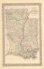
72490-1-map.tif
New rail road and county map of Arkansas, Louisiana & Mississippi / George F. Cram Co.
https://da.mdah.ms.gov/series/maps/detail/191516
-
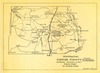
69741-map-01.tif
Problem areas in soil conservation Mississippi : Simpson Soil Conservation District, Simpson County,
Simpson County
https://da.mdah.ms.gov/series/maps/detail/191470
-
14191-1-map.tif
Plat of land in Adams County : surveyed for Samuel Chamberlain and James F. McCaleb / I.
Adams County
https://da.mdah.ms.gov/series/maps/detail/191317
-
69739-map-01.tif
Map of Washington County, Mississippi : showing drainage canals, public roads, railroads and public levee
Washington County
https://da.mdah.ms.gov/series/maps/detail/191466
-
69739-map-02.tif
Map of Washington County, Mississippi: showing drainage canals, public roads, railroads and public levee
Washington County
https://da.mdah.ms.gov/series/maps/detail/191467
-
14151-1-map.tif
Map of Elliot Mission, Grenada County, Miss. / drawn by Loring S. Williams (photocopy).
Grenada County
https://da.mdah.ms.gov/series/maps/detail/191300
-
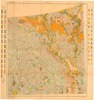
72492-map.tif
Part of Township 20, R26, Leflore County: showing Yallabusha (sic) River, Charley's Trail, Patacocone
Leflore County
https://da.mdah.ms.gov/series/maps/detail/191518
-
67719-1-map.tif
A Sketch of Carroll County showing the lands of the state bid in for taxes for 1861 / by S. Moore.
Carroll County
https://da.mdah.ms.gov/series/maps/detail/191325
-
72518-01-map.tif
Scarborough's new county post office map of Louisiana and Mississippi : with complete index giving population
https://da.mdah.ms.gov/series/maps/detail/191541
-
14173-1-map.tif
Chart of the sources of the Mobile and of the River Yazoo : including a part of the course of the Mississipi
https://da.mdah.ms.gov/series/maps/detail/191312