Historical Maps
The Mississippi Department of Archives and History has cataloged over 2,500 maps in its "published information" collection. They include hand-drawn sketches of towns, localities, plantations, and battlefields, as well as published maps from the sixteenth through twenty-first centuries.
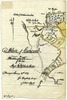
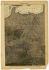
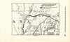
MDAH staff digitized over 600 paper maps for this online exhibit. The earliest is a triptych printed by the famous Dutch cartographer Abraham Ortelius in 1588, including La Florida, drawn by Geronimo Chaves. In his book The Southeast in Early Maps, William P. Cumming called La Florida "one of the half-dozen most important mother maps of southeastern North America." Several maps in the exhibit trace the history of Mississippi from early exploration through colonial expansion, the territorial period, and statehood. Others are hand-drawn plans and plats of towns, such as P. A. Van Dorn's original plan for the city of Jackson in 1822.
Many maps can also be found in other MDAH collections, such as government records and personal papers. One such example is included in this exhibit, the colorful map of the town of Washington, Mississippi, hand drawn by B. L. C. Wailes in the town's 1838 Minute Book. Maps that other state government agencies (especially the Mississippi Department of Transportation) have scanned to document work projects and then transferred to MDAH are not included here but can be accessed with other electronic government records.
Read MoreThe Mississippi Department of Archives and History has cataloged over 2,500 maps in its "published information" collection. They include hand-drawn sketches of towns, localities, plantations, and battlefields, as well as published maps from the sixteenth through twenty-first centuries.
MDAH staff digitized over 600 paper maps for this online exhibit. The earliest is a triptych printed by the famous Dutch cartographer Abraham Ortelius in 1588, including La Florida, drawn by Geronimo Chaves. In his book The Southeast in Early Maps, William P. Cumming called La Florida "one of the half-dozen most important mother maps of southeastern North America." Several maps in the exhibit trace the history of Mississippi from early exploration through colonial expansion, the territorial period, and statehood. Others are hand-drawn plans and plats of towns, such as P. A. Van Dorn's original plan for the city of Jackson in 1822.
Many maps can also be found in other MDAH collections, such as government records and personal papers. One such example is included in this exhibit, the colorful map of the town of Washington, Mississippi, hand drawn by B. L. C. Wailes in the town's 1838 Minute Book. Maps that other state government agencies (especially the Mississippi Department of Transportation) have scanned to document work projects and then transferred to MDAH are not included here but can be accessed with other electronic government records.
You may try wrapping a query in double quotes for more specific results (e.g. "yazoo county").
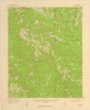
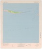
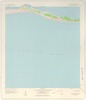
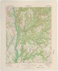
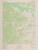
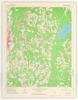
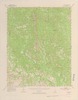
Showing results 151-200 of 318 for yazoo county
-
72516_map.tif
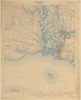
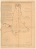
Map showing southern portion of Harrison County from Bay St.
https://da.mdah.ms.gov/series/maps/detail/191538
-
72541-map-01.tif
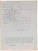
Shows counties, county seats and county supervisor beats.
https://da.mdah.ms.gov/series/maps/detail/191553

-
8063-1-map.tif
The Chickasaw country in 1796-1800 / G.H.V. Collot.
https://da.mdah.ms.gov/series/maps/detail/191055
-
13910-1-map.tif
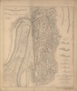
Township no. 24 range no. 1 west [Tallahatchie County, Miss.].
Tallahatchie County
https://da.mdah.ms.gov/series/maps/detail/191210
-
72539-map-01.tif
Shows county population, percentage of total state population, illiteracy.
https://da.mdah.ms.gov/series/maps/detail/191552
-
14003-map.tif
A map of the country adjacent to the River Misisipi /copied by A[lexander] S[potswood] from the original
https://da.mdah.ms.gov/series/maps/detail/191243
-
13840-01-map.tif
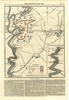
Map of the country between Milliken's Bend, La., and Jackson, Miss. : Vicksburg campaign.
https://da.mdah.ms.gov/series/maps/detail/191156

-
71108-1-map.tif
Dougherty, surveyor of Adams County (photographic copy).
Adams County
https://da.mdah.ms.gov/series/maps/detail/191501
-
14033-map.tif
A map of the country comprised in the state of Mississippi : as known in the year 1764 / by Eman.
https://da.mdah.ms.gov/series/maps/detail/191254
-
14154-1-map.tif
Dougherty, surveyor of Adams County. Hand drawn on trace paper by Louise Hernandez.
Adams County
https://da.mdah.ms.gov/series/maps/detail/191302
-
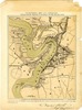
98570-map-1.tif
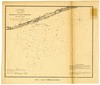
Birds-eye view of the Mississippi River and the adjacent country, from St.
https://da.mdah.ms.gov/series/maps/detail/191682
-
98570-map-2.tif
Birds-eye view of the Mississippi River and the adjacent country, from St.
https://da.mdah.ms.gov/series/maps/detail/191683
-
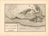
13947_1_map.tif
the Mitchell map (1755) to show the trail probably followed by De Soto's army from the Chickasaw country
https://da.mdah.ms.gov/series/maps/detail/191231
-
14070-map-01.tif
Maurepas, and the river Ibberville : and also of the river Mississippi from its mouth to the river Yazou
https://da.mdah.ms.gov/series/maps/detail/191262
-
14070-map-02.tif
Maurepas, and the river Ibberville: and also of the river Mississippi from its mouth to the river Yazou
https://da.mdah.ms.gov/series/maps/detail/191263

-
72513-01-map.tif
Exhibit map to cross-bill in case state of Louisiana versus state of Mississippi : Supreme Court of United
https://da.mdah.ms.gov/series/maps/detail/191534
-
-
-
-
-
-
-
-
-
-
-
-

-
-
-
-
-

-
-

-
-
-
-
-
-
-
-
-

-
-
-
-
-
-