
Rogers (Jeff) Hurricane Katrina Photographs PI/2005.0024
On August 29, 2005, Katrina made landfall on the Mississippi-Louisiana state line as a strong category 3 hurricane with sustained winds of 125mph and minimum central pressure the third lowest on record (920mb). Waveland, Bay St. Louis, Pass Christian, and Long Beach, Mississippi bore the brunt of Katrina's force, though central Gulf Coast cities such as Gulfport, Biloxi, Ocean Springs, and Pascagoula, Mississippi, and New Orleans, Louisiana, received significant damage. It had diminished only to a cat. 1 hurricane (wind speeds of 75mph or greater) when it reached central Mississippi later that day.
The collection consists of 103 color photographs taken by MDAH Graphic Records Curator Jeff Rogers that document Hurricane Katrina's destructive path through the Mississippi Gulf Coast and central Mississippi. Photographs show damage to civic, commercial, religious, and residential structures between August 29 and September 27, 2005.
Read MoreOn August 29, 2005, Katrina made landfall on the Mississippi-Louisiana state line as a strong category 3 hurricane with sustained winds of 125mph and minimum central pressure the third lowest on record (920mb). Waveland, Bay St. Louis, Pass Christian, and Long Beach, Mississippi bore the brunt of Katrina's force, though central Gulf Coast cities such as Gulfport, Biloxi, Ocean Springs, and Pascagoula, Mississippi, and New Orleans, Louisiana, received significant damage. It had diminished only to a cat. 1 hurricane (wind speeds of 75mph or greater) when it reached central Mississippi later that day.
The collection consists of 103 color photographs taken by MDAH Graphic Records Curator Jeff Rogers that document Hurricane Katrina's destructive path through the Mississippi Gulf Coast and central Mississippi. Photographs show damage to civic, commercial, religious, and residential structures between August 29 and September 27, 2005.
-
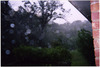
"Kings Ridge Dr., Rankin County, MS. Monday, August 29, 2005. View of wind and rain as Hurricane Katrina passed through the Jackson Metropolitan Area."
Date: 2005-08-29
Creator: Rogers, Jeff
Filename: 103546-01-photo.tif
-
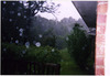
"Kings Ridge Dr., Rankin County, MS. Monday, August 29, 2005. View of wind and rain as Hurricane Katrina passed through the Jackson Metropolitan Area."
Date: 2005-08-29
Creator: Rogers, Jeff
Filename: 103547-01-photo.tif
-

"Kings Ridge Dr., Rankin County, MS. Monday, August 29, 2005. View of wind and rain as Hurricane Katrina passed through the Jackson Metropolitan Area."
Date: 2005-08-29
Creator: Rogers, Jeff
Filename: 103548-01-photo.tif
-

"Rankin County, MS. Northshore Parkway, Ross Barnett Reservoir. Tuesday, August 30, 2005. Looking north at guardrail that was damaged by Hurricane Katrina."
Date: 2005-08-30
Creator: Rogers, Jeff
Filename: 103549-01-photo.tif
-
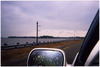
"Rankin County, MS. Northshore Parkway, Ross Barnett Reservoir. Tuesday, August 30, 2005. View looking north at guardrail damaged by Hurricane Katrina."
Date: 2005-08-30
Creator: Rogers, Jeff
Filename: 103550-01-photo.tif
-
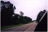
"Rankin County, MS. Northshore Parkway near Fox Bay Subdivision. Tuesday, August 30, 2005. Looking east as utility crews repair lines that were damaged by Hurricane Katrina."
Date: 2005-08-30
Creator: Rogers, Jeff
Filename: 103551-01-photo.tif
-
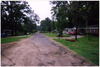
"Rankin County, MS. Tuesday, August 30, 2005. Looking southeast on Harbor Lane."
Date: 2005-08-30
Creator: Rogers, Jeff
Filename: 103552-01-photo.tif
-
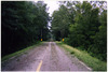
"Good Hope, Leake County, MS. Tuesday, August 30, 2005. Looking south on Highway 13. Trees and debris cover highway."
Date: 2005-08-30
Creator: Rogers, Jeff
Filename: 103553-01-photo.tif
-

"Scott County, MS. 479 County Line Road. Tuesday, August 30, 2005. Tree that was split by Hurricane Katrina."
Date: 2005-08-30
Creator: Rogers, Jeff
Filename: 103555-01-photo.tif
-
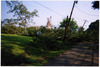
"Pelahatchie, Rankin County, MS. Wednesday, August 31, 2005. Looking north on Mimosa Dr. Trees and power lines damaged by Hurricane Katrina."
Date: 2005-08-31
Creator: Rogers, Jeff
Filename: 103558-01-photo.tif
-
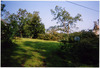
"Pelahatchie, Rankin County, MS. Wednesday, August 31, 2005. Looking northwest from Mimosa Drive. Trees and power lines damaged by Hurricane Katrina."
Date: 2005-08-31
Creator: Rogers, Jeff
Filename: 103559-01-photo.tif
-
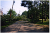
"Pelahatchie, Rankin County, MS. Wednesday, August 31, 2005. Looking north on Mimosa Drive. Trees and power lines damaged by Hurricane Katrina."
Date: 2005-08-31
Creator: Rogers, Jeff
Filename: 103560-01-photo.tif
-
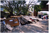
"Pascagoula, Jackson County, MS. Friday, September 16, 2005. Pascagoula Public Library, 3214 Pascagoula Street. Debris that has been removed from first floor of building."
Date: 2005-09-16
Creator: Rogers, Jeff
Filename: 103561-01-photo.tif
-

"Pascagoula, Jackson County, MS. Friday, September 16, 2005. Pascagoula Public Library. First floor where dry wall, flooring and shelving have been removed. Books and newspapers."
Date: 2005-09-16
Creator: Rogers, Jeff
Filename: 103562-01-photo.tif
-

"Pascagoula, Jackson County, MS. Friday, September 16, 2005. Books, tapes and DVDs that have been stacked on the first floor because shelving has been removed."
Date: 2005-09-16
Creator: Rogers, Jeff
Filename: 103563-01-photo.tif
-
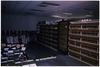
"Pascagoula, Jackson County, MS. Friday September 16, 2005. Pascagoula Public Library. Workers stack books on floor in preparation to remove shelving in the law library section."
Date: 2005-09-16
Creator: Rogers, Jeff
Filename: 103564-01-photo.tif
-
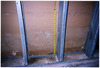
"Pascagoula, Jackson County, MS. Friday September 16, 2005. Mold on dry wall on the west wall of the law library."
Date: 2005-09-16
Creator: Rogers, Jeff
Filename: 103565-01-photo.tif
-

"Pascagoula, Jackson County, MS. Friday, September 16, 2005. Main entrance where debris from building has been placed."
Date: 2005-09-16
Creator: Rogers, Jeff
Filename: 103566-01-photo.tif
-
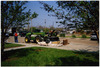
"Pascagoula, Jackson County, MS. Friday September 16, 2005. Looking north from main building as machinery loads debris onto trucks."
Date: 2005-09-16
Creator: Rogers, Jeff
Filename: 103567-01-photo.tif
-
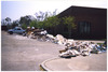
"Pascagoula, Jackson County, MS. Friday September 16, 2005. Looking east toward main building. Debris that was removed from the building is stacked for disposal."
Date: 2005-09-16
Creator: Rogers, Jeff
Filename: 103568-01-photo.tif
-
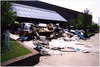
"Pascagoula, Jackson County, MS. Friday September 16, 2005. Looking southeast toward main entrance. Debris that was removed from building is stacked for disposal."
Date: 2005-09-16
Creator: Rogers, Jeff
Filename: 103569-01-photo.tif
-
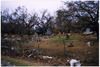
"Ocean Springs, Jackson County, MS. Friday September 16, 2005. Washington Avenue, approximately two blocks north of Front Beach Drive."
Date: 2005-09-16
Creator: Rogers, Jeff
Filename: 103570-01-photo.tif
-
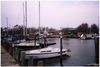
"Ocean Springs, Jackson County, MS. Friday September 16, 2005. Looking north, marina at Inner Harbor."
Date: 2005-09-16
Creator: Rogers, Jeff
Filename: 103571-01-photo.tif
-
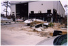
"Ocean Springs, Jackson County, MS. Friday September 16, 2005. Looking west from Harbor Road. Boat storage facility that has been damaged by Hurricane Katrina storm surge."
Date: 2005-09-16
Creator: Rogers, Jeff
Filename: 103572-01-photo.tif
-
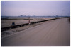
"Ocean Springs, Jackson County, MS. Friday September 16, 2005. Looking west, from Front Beach Drive, toward Biloxi. Bay bridge and casino hotels in distance."
Date: 2005-09-16
Creator: Rogers, Jeff
Filename: 103573-01-photo.tif
-
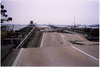
"Ocean Springs, Jackson County, MS. Friday September 16, 2005. Looking southwest across Biloxi Bay. U.S. Highway 90 bridge damaged by Hurricane Katrina storm surge."
Date: 2005-09-16
Creator: Rogers, Jeff
Filename: 103574-01-photo.tif
-
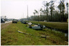
"Hancock County, MS. Monday, September 19, 2005. Looking southeast on MS Highway 43. Automobiles that had been parked along the highway to avoid high water."
Date: 2005-09-19
Creator: Rogers, Jeff
Filename: 103575-01-photo.tif
-
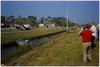
"Hancock County, MS. Monday, September 19, 2005. Looking northwest on MS Highway 43. Automobiles that were parked along highway to avoid high water."
Date: 2005-09-19
Creator: Rogers, Jeff
Filename: 103576-01-photo.tif
-
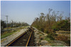
"Waveland, Hancock County, MS. Monday, September 19, 2005. Looking southwest, from intersection of Nicholson Avenue and Central Avenue, at CSX railroad track."
Date: 2005-09-19
Creator: Rogers, Jeff
Filename: 103577-01-photo.tif
-
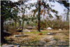
"Waveland, Hancock County, MS. Monday, September 19, 2005. Ruins of home located on the northwest corner of Nicholson Avenue and Central Avenue."
Date: 2005-09-19
Creator: Rogers, Jeff
Filename: 103578-01-photo.tif
-

"Waveland, Hancock County, MS. Monday, September 19, 2005. Debris and ruins of home, which was second house north of the beach, on Nicholson Avenue. Looking southwest toward beach."
Date: 2005-09-19
Creator: Rogers, Jeff
Filename: 103579-01-photo.tif
-
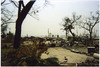
"Waveland, Hancock County, MS. Monday, September 19, 2005. Looking south toward Beach Boulevard. Ruins of home located on southwest side of Nicholson Avenue."
Date: 2005-09-19
Creator: Rogers, Jeff
Filename: 103580-01-photo.tif