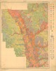
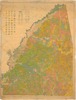
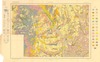
Historical Maps
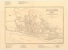
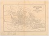
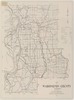
The Mississippi Department of Archives and History has cataloged over 2,500 maps in its "published information" collection. They include hand-drawn sketches of towns, localities, plantations, and battlefields, as well as published maps from the sixteenth through twenty-first centuries.
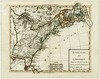
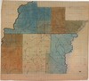
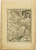
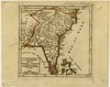
MDAH staff digitized over 600 paper maps for this online exhibit. The earliest is a triptych printed by the famous Dutch cartographer Abraham Ortelius in 1588, including La Florida, drawn by Geronimo Chaves. In his book The Southeast in Early Maps, William P. Cumming called La Florida "one of the half-dozen most important mother maps of southeastern North America." Several maps in the exhibit trace the history of Mississippi from early exploration through colonial expansion, the territorial period, and statehood. Others are hand-drawn plans and plats of towns, such as P. A. Van Dorn's original plan for the city of Jackson in 1822.
Many maps can also be found in other MDAH collections, such as government records and personal papers. One such example is included in this exhibit, the colorful map of the town of Washington, Mississippi, hand drawn by B. L. C. Wailes in the town's 1838 Minute Book. Maps that other state government agencies (especially the Mississippi Department of Transportation) have scanned to document work projects and then transferred to MDAH are not included here but can be accessed with other electronic government records.
Read MoreThe Mississippi Department of Archives and History has cataloged over 2,500 maps in its "published information" collection. They include hand-drawn sketches of towns, localities, plantations, and battlefields, as well as published maps from the sixteenth through twenty-first centuries.
MDAH staff digitized over 600 paper maps for this online exhibit. The earliest is a triptych printed by the famous Dutch cartographer Abraham Ortelius in 1588, including La Florida, drawn by Geronimo Chaves. In his book The Southeast in Early Maps, William P. Cumming called La Florida "one of the half-dozen most important mother maps of southeastern North America." Several maps in the exhibit trace the history of Mississippi from early exploration through colonial expansion, the territorial period, and statehood. Others are hand-drawn plans and plats of towns, such as P. A. Van Dorn's original plan for the city of Jackson in 1822.
Many maps can also be found in other MDAH collections, such as government records and personal papers. One such example is included in this exhibit, the colorful map of the town of Washington, Mississippi, hand drawn by B. L. C. Wailes in the town's 1838 Minute Book. Maps that other state government agencies (especially the Mississippi Department of Transportation) have scanned to document work projects and then transferred to MDAH are not included here but can be accessed with other electronic government records.
You may try wrapping a query in double quotes for more specific results (e.g. "de soto county").
Showing results 51-100 of 351 for de soto county
-
69776-map-1.tif
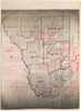
Bolivar County, T17R5W.
Bolivar County
https://da.mdah.ms.gov/series/maps/detail/191492
-
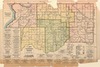
69779-map-01.tif
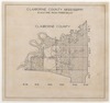
Claiborne County, Mississippi.
Claiborne County
https://da.mdah.ms.gov/series/maps/detail/191494
-
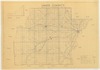
69723-map-01.tif
Winston County, Mississippi [map] / LaSueur.
Winston County
https://da.mdah.ms.gov/series/maps/detail/928318
-
-
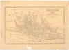
14135-1-map.tif
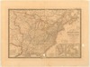
Etats-Unis de l'Amerique : divises en 13 provinces avec leurs limites suivant le traite de paix fait
https://da.mdah.ms.gov/series/maps/detail/191295
-
67817-01-map.tif
Mississippi, Clarke County sheet / U.S.
Clarke County
https://da.mdah.ms.gov/series/maps/detail/191328

-
69691-01-map.tif
Weathersby, Simpson County, Mississippi / J.F. Thames.
Simpson County
https://da.mdah.ms.gov/series/maps/detail/191432

-
69762-map-01.tif
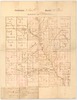
T2SR15W county of Marion. Names of landowners handwritten on lots.
Marion County
https://da.mdah.ms.gov/series/maps/detail/191482
-
72515-map-01.tif
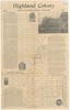
Ridgeland, Madison County, Mississippi / Highland Colony Company.
Madison County
https://da.mdah.ms.gov/series/maps/detail/191536
-
72515-map-02.tif
Ridgeland, Madison County, Mississippi / Highland Colony Company.
Madison County
https://da.mdah.ms.gov/series/maps/detail/191537

-
72524_map.tif
Map of Hinds County / Jeff D. Bell, copied by Elsie Timberlake.
Hinds County
https://da.mdah.ms.gov/series/maps/detail/191547
-
13893-01-map.tif
Robert de Vaugondy fils de Mr. Robert géog. du roi, 1749.
Robert de Vaugondy, Didier
https://da.mdah.ms.gov/series/maps/detail/191193
-
13898-1-map.tif
La Floride divisee en Floride et Caroline / [Gilles] Robert de Vaugondy.
Robert de Vaugondy, Gilles
https://da.mdah.ms.gov/series/maps/detail/191198
-
14120-map.tif
Etablissement du Poste des Akansas aux Ecores Rouges de 17 Mars 1779.
https://da.mdah.ms.gov/series/maps/detail/191288

-
13899-01-map.tif
Adams County, land holdings, 1810.
Adams County
https://da.mdah.ms.gov/series/maps/detail/191199
-
14192-1-map.tif
Adams County land plat map / [drawn by] Louise Hernandez. Pen-and-ink on trace paper.
Adams County
https://da.mdah.ms.gov/series/maps/detail/191318
-
67716-map-01.tif
Map of Adams County, Mississippi / C.W. Babbit, County Surveyor, Natchez.
Adams County
https://da.mdah.ms.gov/series/maps/detail/191324
-
67818-1-map.tif
Soil map, Mississippi : Claiborne County / U.S.
Claiborne County
https://da.mdah.ms.gov/series/maps/detail/191329
-
69300-1-map.tif
Soil map, Mississippi : Harrison County / U.S.
Harrison County
https://da.mdah.ms.gov/series/maps/detail/191355
-
69301-map-1.tif
Map of Hancock County, Mississippi / drawn by B.E.
Connell's fishing map of Hancock County, Mississippi.
Hancock County
https://da.mdah.ms.gov/series/maps/detail/191356
-
69314-map-01.tif
Map of Desoto County, Mississippi / compiled by R. F. B. Logan.
DeSoto County
https://da.mdah.ms.gov/series/maps/detail/191359
-
69342-map-01.tif
Hinds County white school map.
Hinds County
https://da.mdah.ms.gov/series/maps/detail/191367
-
69679-map-01.tif
Vicksburg, Warren County, Mississippi, 1930 / James D. Bryan, delineator.
Warren County
https://da.mdah.ms.gov/series/maps/detail/191426
-
69680-map-01.tif
Vicksburg, Warren County, Mississippi, 1930 / James D. Bryan, Delineator.
Warren County
https://da.mdah.ms.gov/series/maps/detail/191427
-
69681-map-01.tif
Vicksburg, Warren County, Mississippi, 1930 / James D. Bryan, Delineator.
Warren County
https://da.mdah.ms.gov/series/maps/detail/191428
-
69725-map-01.tif
Redistricting plan : Wilkinson County, Mississippi.
Wilkinson County
https://da.mdah.ms.gov/series/maps/detail/191458

-
69740-map-01.tif
Map of Washington County, Mississippi / Board of Supervisors, side 2.
Washington County
https://da.mdah.ms.gov/series/maps/detail/191468
-
69740-map-02.tif
Map of Washington County, Mississippi / Board of Supervisors, side 1.
Washington County
https://da.mdah.ms.gov/series/maps/detail/191469
-
69743-map-01.tif
Simpson County, map no. 4. T2N R4E.
Simpson County
https://da.mdah.ms.gov/series/maps/detail/191471
-
69750-map-01.tif
Map of Pearl River County.
Pearl River County
https://da.mdah.ms.gov/series/maps/detail/191473
-
69764-map-01.tif
Madison County : white school map.
Madison County
https://da.mdah.ms.gov/series/maps/detail/191483
-
69772-map-c1-01.tif
Map of Lee County, Mississippi / Board of Supervisors, Tupelo, Mississippi, copy 1.
Lee County
https://da.mdah.ms.gov/series/maps/detail/191487
-
69772-map-c2-01.tif
Map of Lee County, Mississippi / Board of Supervisors, Tupelo, Mississippi, copy 2.
Lee County
https://da.mdah.ms.gov/series/maps/detail/191488
-
69773-map-01.tif
Map of Lee County, Mississippi / compiled by the Board of Supervisors, Tupelo, Mississippi.
Lee County
https://da.mdah.ms.gov/series/maps/detail/191489
-
69774-map-01.tif
Map of Lee County, Mississippi. Jeff A. Hopkins' map showing trails, etc.
Lee County
https://da.mdah.ms.gov/series/maps/detail/191490
-
71041-map-01.tif
General highway map : Sunflower County.
Sunflower County
https://da.mdah.ms.gov/series/maps/detail/191498
-
85530-1-map.tif
Soil map, Mississippi : Clay County / U.S. Department of Agriculture, Bureau of Soils.
Clay County
https://da.mdah.ms.gov/series/maps/detail/191640
-
85545-1-map.tif
Soil map, Mississippi : Greene County / U.S.
Greene County
https://da.mdah.ms.gov/series/maps/detail/191645
-
85586-1-map.tif
Soil map, Mississippi : Hancock County / U.S.
Hancock County
https://da.mdah.ms.gov/series/maps/detail/191646
-
85653-1-map.tif
Soil map, Mississippi : Jackson County / U.S.
Jackson County
https://da.mdah.ms.gov/series/maps/detail/191647
-
85654-1-map.tif
Soil map : Mississippi, Jasper County / U.S.
Jasper County
https://da.mdah.ms.gov/series/maps/detail/191648

-
85743-1-map.tif
Soil map, Mississippi : Marion County / U.S.
Marion County
https://da.mdah.ms.gov/series/maps/detail/191657
-
85875-1-map.tif
Soil map, Mississippi: Rankin County / U.S.
Rankin County
https://da.mdah.ms.gov/series/maps/detail/191668
-
377-1-map.tif
Carte de la Louisiane et pays voisins : pour servir a l'Histoire general des voyages / Par M.
B., ing. de la marine. Tom XIV. No. 12.
https://da.mdah.ms.gov/series/maps/detail/191026

-
67712-1-map.tif
Soil map, Mississippi : Alcorn County sheet / U.S.
Published originally as an attached map with Soil survey of Alcorn County, Mississippi / E.
Alcorn County
https://da.mdah.ms.gov/series/maps/detail/191321
-
69333_map.tif
Jefferson County, Mississippi : general highway map / prepared by Mississippi State Highway Department
Jefferson County
https://da.mdah.ms.gov/series/maps/detail/191363
-
69340-1-map.tif
Soil map, Mississippi: Grenada County sheet / U.S.
Grenada County
https://da.mdah.ms.gov/series/maps/detail/191366
-
69345-1-map.tif
Soil map, Mississippi, Adams County sheet / U.S.
Adams County
https://da.mdah.ms.gov/series/maps/detail/191369
-
69689-map-01.tif
City of Vicksburg, Warren County, Vicksburg / by O.M.
Warren County
https://da.mdah.ms.gov/series/maps/detail/191430
-
69760-1-map.tif
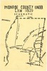
Monroe County under law 1829 : schematic.
Monroe County
https://da.mdah.ms.gov/series/maps/detail/191480