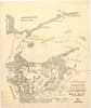
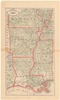
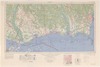
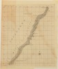
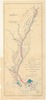
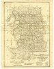
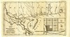
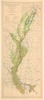
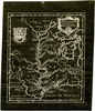
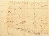
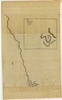
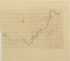
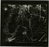
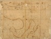
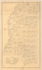
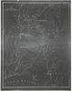
Historical Maps
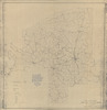
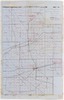
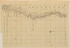
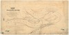
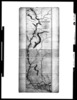
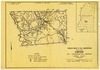
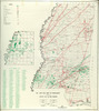
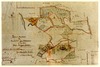
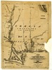
The Mississippi Department of Archives and History has cataloged over 2,500 maps in its "published information" collection. They include hand-drawn sketches of towns, localities, plantations, and battlefields, as well as published maps from the sixteenth through twenty-first centuries.
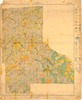
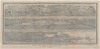
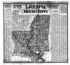
MDAH staff digitized over 600 paper maps for this online exhibit. The earliest is a triptych printed by the famous Dutch cartographer Abraham Ortelius in 1588, including La Florida, drawn by Geronimo Chaves. In his book The Southeast in Early Maps, William P. Cumming called La Florida "one of the half-dozen most important mother maps of southeastern North America." Several maps in the exhibit trace the history of Mississippi from early exploration through colonial expansion, the territorial period, and statehood. Others are hand-drawn plans and plats of towns, such as P. A. Van Dorn's original plan for the city of Jackson in 1822.
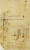
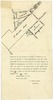
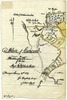
Many maps can also be found in other MDAH collections, such as government records and personal papers. One such example is included in this exhibit, the colorful map of the town of Washington, Mississippi, hand drawn by B. L. C. Wailes in the town's 1838 Minute Book. Maps that other state government agencies (especially the Mississippi Department of Transportation) have scanned to document work projects and then transferred to MDAH are not included here but can be accessed with other electronic government records.
Read MoreThe Mississippi Department of Archives and History has cataloged over 2,500 maps in its "published information" collection. They include hand-drawn sketches of towns, localities, plantations, and battlefields, as well as published maps from the sixteenth through twenty-first centuries.
MDAH staff digitized over 600 paper maps for this online exhibit. The earliest is a triptych printed by the famous Dutch cartographer Abraham Ortelius in 1588, including La Florida, drawn by Geronimo Chaves. In his book The Southeast in Early Maps, William P. Cumming called La Florida "one of the half-dozen most important mother maps of southeastern North America." Several maps in the exhibit trace the history of Mississippi from early exploration through colonial expansion, the territorial period, and statehood. Others are hand-drawn plans and plats of towns, such as P. A. Van Dorn's original plan for the city of Jackson in 1822.
Many maps can also be found in other MDAH collections, such as government records and personal papers. One such example is included in this exhibit, the colorful map of the town of Washington, Mississippi, hand drawn by B. L. C. Wailes in the town's 1838 Minute Book. Maps that other state government agencies (especially the Mississippi Department of Transportation) have scanned to document work projects and then transferred to MDAH are not included here but can be accessed with other electronic government records.
You may try wrapping a query in double quotes for more specific results (e.g. "pearl River county").
Showing results 151-200 of 370 for pearl River county
-
69730-1-map.tif
Township 15, range 3 east : Warren County.
Warren County
https://da.mdah.ms.gov/series/maps/detail/191462
-
69766-map-01.tif
Columbus Separate School District : Lowndes County, Miss. / D.E. Field, civil engineer
Lowndes County
https://da.mdah.ms.gov/series/maps/detail/191485
-
85683-1-map.tif
Soil map, Mississippi : Jefferson Davis County sheet / U.S.
Jefferson Davis County
https://da.mdah.ms.gov/series/maps/detail/191649
-
67723-1-map.tif
Choctaw County, Mississippi
Rural delivery routes [map] : Choctaw County, Miss. / United States Post Office Department.
Choctaw County
https://da.mdah.ms.gov/series/maps/detail/897298
-
67720-map-01.tif
Department of Education : Calhoun County, May 19, 1928 / by Q.T. Crowson, Supt. of Ed.
Calhoun County
https://da.mdah.ms.gov/series/maps/detail/191326
-
72491-01-map.tif
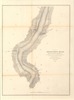
Bird's eye view of the Mississippi River from the mouth of the Missouri to the Gulf of Mexico, 1883 /
https://da.mdah.ms.gov/series/maps/detail/191517
-
14111-3-map.tif
Southern boundary from the northeast branch of Thompson's Creek to the Pearl River.
https://da.mdah.ms.gov/series/maps/detail/191276
-
-
8204-01-c2-map.tif
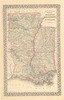
County map of the states of Arkansas, Mississippi, and Louisiana / drawn and engraved by W. H.
https://da.mdah.ms.gov/series/maps/detail/191134
-
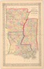
8205-1-map.tif
County map of the states of Arkansas, Mississippi, and Louisiana.
https://da.mdah.ms.gov/series/maps/detail/191135
-
69666-01-map.tif
Map of the city of Natchez suburbs : Adams County, Mississippi, 1891 / Chs. W.
Babbitt, C.E., city and county surveyor.
Adams County
https://da.mdah.ms.gov/series/maps/detail/191421
-
72490-1-map.tif
New rail road and county map of Arkansas, Louisiana & Mississippi / George F. Cram Co.
https://da.mdah.ms.gov/series/maps/detail/191516
-
14111-B-map.tif
Ohio River from Cincinnati to the Mississippi River.
https://da.mdah.ms.gov/series/maps/detail/191283
-
72605-map-01.tif
Mobile / Mississippi River Commission, U.S. Army Corps of Engineers, Vicksburg, Miss.
Mobile County
https://da.mdah.ms.gov/series/maps/detail/191581
-
14111-C-map.tif
Mississippi River from the Ohio to the Arkansas River.
https://da.mdah.ms.gov/series/maps/detail/191284
-
14111-D-map.tif
Mississippi River from the Arkansas River to Willing's Bayou.
https://da.mdah.ms.gov/series/maps/detail/191285
-
13900-01-map.tif
. : showing the changes wrought by the river above and below Vicksburg by the cut-off at Vicksburg /
https://da.mdah.ms.gov/series/maps/detail/191200
-
457_map.tif
Course of the river Mississipi, from the Balise to Fort Chartres : taken on an expedition to the Illinois
Ross of the 34th regiment ; improved from the surveys of that river made by the French.
https://da.mdah.ms.gov/series/maps/detail/191033
-
69741-map-01.tif
Problem areas in soil conservation Mississippi : Simpson Soil Conservation District, Simpson County,
Simpson County
https://da.mdah.ms.gov/series/maps/detail/191470
-
72670-map-01.tif
The alluvial valley of the Mississippi River : to accompany report of Major General Edgar Jadwin, Chief
https://da.mdah.ms.gov/series/maps/detail/191614
-
14191-1-map.tif
Plat of land in Adams County : surveyed for Samuel Chamberlain and James F. McCaleb / I.
Adams County
https://da.mdah.ms.gov/series/maps/detail/191317
-
69739-map-01.tif
Map of Washington County, Mississippi : showing drainage canals, public roads, railroads and public levee
Washington County
https://da.mdah.ms.gov/series/maps/detail/191466
-
69739-map-02.tif
Map of Washington County, Mississippi: showing drainage canals, public roads, railroads and public levee
Washington County
https://da.mdah.ms.gov/series/maps/detail/191467
-
14045-1-map.tif
A map of part of West Florida : from Pensacola to the mouth of the Iberville River, with a view to shew
https://da.mdah.ms.gov/series/maps/detail/191256
-
72534_MS_River_Flood_Map.tif
Mississippi River Flood of 1927 : showing flooded areas and field of operations under Herbert Hoover,
https://da.mdah.ms.gov/series/maps/detail/191551
-
14151-1-map.tif
Map of Elliot Mission, Grenada County, Miss. / drawn by Loring S. Williams (photocopy).
Grenada County
https://da.mdah.ms.gov/series/maps/detail/191300
-
-
67719-1-map.tif
A Sketch of Carroll County showing the lands of the state bid in for taxes for 1861 / by S. Moore.
Carroll County
https://da.mdah.ms.gov/series/maps/detail/191325
-
72518-01-map.tif
Scarborough's new county post office map of Louisiana and Mississippi : with complete index giving population
https://da.mdah.ms.gov/series/maps/detail/191541
-
14111-7-map.tif
Lower portion of the Chattahoochee River.
https://da.mdah.ms.gov/series/maps/detail/191280
-
14111-A-map.tif
Ohio River from Pittsburg to Cincinnati.
https://da.mdah.ms.gov/series/maps/detail/191282
-
14111-5-map.tif
Southern boundary from the Mobile to the Conecuh River.
https://da.mdah.ms.gov/series/maps/detail/191278
-
14111-6-map.tif
Southern boundary from the Conecuh to the Chattahoochee River.
https://da.mdah.ms.gov/series/maps/detail/191279
-
14111-8-map.tif
Mary's River from its source in the Okefenokee Swamp.
https://da.mdah.ms.gov/series/maps/detail/191281
-
13990-1-map.tif
The territory between the Chattahoochee and Mississippi Rivers / Baron de Crenay.
https://da.mdah.ms.gov/series/maps/detail/191241
-
14111-2-map.tif
Southern boundary from the Mississippi River to the north branch of Thompson's Creek.
https://da.mdah.ms.gov/series/maps/detail/191275
-
72516_map.tif
Map showing southern portion of Harrison County from Bay St.
https://da.mdah.ms.gov/series/maps/detail/191538
-
14111-E-map.tif
Southern Boundary of the United States and the Mississippi River from Fort Adams to its mouth.
https://da.mdah.ms.gov/series/maps/detail/191286
-
72541-map-01.tif
Shows counties, county seats and county supervisor beats.
https://da.mdah.ms.gov/series/maps/detail/191553
-
8063-1-map.tif
The Chickasaw country in 1796-1800 / G.H.V. Collot.
https://da.mdah.ms.gov/series/maps/detail/191055
-
13910-1-map.tif
Township no. 24 range no. 1 west [Tallahatchie County, Miss.].
Tallahatchie County
https://da.mdah.ms.gov/series/maps/detail/191210
-
72539-map-01.tif
Shows county population, percentage of total state population, illiteracy.
https://da.mdah.ms.gov/series/maps/detail/191552
-
14175-map-1.tif
Covers area on north from Fort Strother on left through Rock Mountain (Stone Mountain) to Appalachee River
Marks River and the Appalachee Bay on the east
https://da.mdah.ms.gov/series/maps/detail/1056140
-
171670-map-01.tif
State of Mississippi: county location of oil and gas fields and pipelines.
https://da.mdah.ms.gov/series/maps/detail/1062363
-
13840-01-map.tif
Map of the country between Milliken's Bend, La., and Jackson, Miss. : Vicksburg campaign.
https://da.mdah.ms.gov/series/maps/detail/191156

-
71108-1-map.tif
Dougherty, surveyor of Adams County (photographic copy).
Adams County
https://da.mdah.ms.gov/series/maps/detail/191501
-
14033-map.tif
A map of the country comprised in the state of Mississippi : as known in the year 1764 / by Eman.
https://da.mdah.ms.gov/series/maps/detail/191254
-
14154-1-map.tif
Dougherty, surveyor of Adams County. Hand drawn on trace paper by Louise Hernandez.
Adams County
https://da.mdah.ms.gov/series/maps/detail/191302
-
13947_1_map.tif
the Mitchell map (1755) to show the trail probably followed by De Soto's army from the Chickasaw country
https://da.mdah.ms.gov/series/maps/detail/191231
-
72513-01-map.tif
Exhibit map to cross-bill in case state of Louisiana versus state of Mississippi : Supreme Court of United
https://da.mdah.ms.gov/series/maps/detail/191534