Historical Maps
The Mississippi Department of Archives and History has cataloged over 2,500 maps in its "published information" collection. They include hand-drawn sketches of towns, localities, plantations, and battlefields, as well as published maps from the sixteenth through twenty-first centuries.
MDAH staff digitized over 600 paper maps for this online exhibit. The earliest is a triptych printed by the famous Dutch cartographer Abraham Ortelius in 1588, including La Florida, drawn by Geronimo Chaves. In his book The Southeast in Early Maps, William P. Cumming called La Florida "one of the half-dozen most important mother maps of southeastern North America." Several maps in the exhibit trace the history of Mississippi from early exploration through colonial expansion, the territorial period, and statehood. Others are hand-drawn plans and plats of towns, such as P. A. Van Dorn's original plan for the city of Jackson in 1822.
Many maps can also be found in other MDAH collections, such as government records and personal papers. One such example is included in this exhibit, the colorful map of the town of Washington, Mississippi, hand drawn by B. L. C. Wailes in the town's 1838 Minute Book. Maps that other state government agencies (especially the Mississippi Department of Transportation) have scanned to document work projects and then transferred to MDAH are not included here but can be accessed with other electronic government records.
Read MoreThe Mississippi Department of Archives and History has cataloged over 2,500 maps in its "published information" collection. They include hand-drawn sketches of towns, localities, plantations, and battlefields, as well as published maps from the sixteenth through twenty-first centuries.
MDAH staff digitized over 600 paper maps for this online exhibit. The earliest is a triptych printed by the famous Dutch cartographer Abraham Ortelius in 1588, including La Florida, drawn by Geronimo Chaves. In his book The Southeast in Early Maps, William P. Cumming called La Florida "one of the half-dozen most important mother maps of southeastern North America." Several maps in the exhibit trace the history of Mississippi from early exploration through colonial expansion, the territorial period, and statehood. Others are hand-drawn plans and plats of towns, such as P. A. Van Dorn's original plan for the city of Jackson in 1822.
Many maps can also be found in other MDAH collections, such as government records and personal papers. One such example is included in this exhibit, the colorful map of the town of Washington, Mississippi, hand drawn by B. L. C. Wailes in the town's 1838 Minute Book. Maps that other state government agencies (especially the Mississippi Department of Transportation) have scanned to document work projects and then transferred to MDAH are not included here but can be accessed with other electronic government records.
You may try wrapping a query in double quotes for more specific results (e.g. "de soto county").
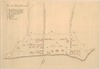
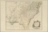
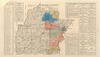
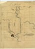
Showing results 1-50 of 351 for de soto county
-
13944-map-1.tif
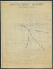
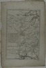
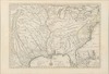
Route of Hernando De Soto and Luis De Moscoso : according to the findings of the U.S.
De Soto expedition commission.
From: The Final Report of the United States De Soto Expedition Commission, facing p. 348.
https://da.mdah.ms.gov/series/maps/detail/191229
-
13943_1_map.tif
From a photocopy of the so-called "De Soto map."
From: The Final Report of the United States De Soto Expedition Commission, facing p. 348.
https://da.mdah.ms.gov/series/maps/detail/191228
-
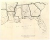
13952-1-map.tif
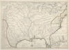
Route of Hernando De Soto and his successor 1539-1543 : according to various students / compiled by J.R
From: The Final Report of the United States De Soto Expedition Commission, facing p. 348.
United States De Soto Expedition Commission
https://da.mdah.ms.gov/series/maps/detail/191235
-
14107-1-map.tif
Plano de la plaza de Panzacola [sic].
Handsketch of original manuscript map located in the Archivo General de Indias, Seville, Spain, 1799.
Escambia County
https://da.mdah.ms.gov/series/maps/detail/191273
-
13891-1-map.tif
Croquis de la posicion del campo de Cerro Gordo : para la inteligencia de la batalla del 18 de Abril
de 1847.
https://da.mdah.ms.gov/series/maps/detail/191191
-
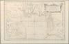
527-1-map.tif
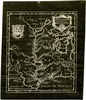
Carte de la Louisiane / par le Sr. d'Anville dressee en mai 1732. [Gravee par] Guille. de la Haye.
https://da.mdah.ms.gov/series/maps/detail/191035
-
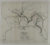
13947_1_map.tif
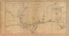
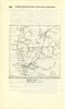
Section of the Mitchell map (1755) to show the trail probably followed by De Soto's army from the Chickasaw
country to the Mississippi.
From: The Final Report of the United States De Soto Expedition Commission, p. 347.
United States De Soto Expedition Commission
https://da.mdah.ms.gov/series/maps/detail/191231
-
13948_1_map.tif
From: The Final Report of the United States De Soto Expedition Commission, p. 348.
United States De Soto Expedition Commission
https://da.mdah.ms.gov/series/maps/detail/191232
-
13950_1_map.tif
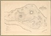
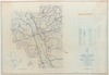
Mckee Island and the supposed site of the town of Tali to illustrate De Soto's visit in 1540.
From: The Final Report of the United States De Soto Expedition Commission, p. 346.
United States De Soto Expedition Commission
https://da.mdah.ms.gov/series/maps/detail/191233
-
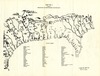
13951_1_map.tif
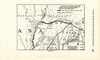
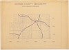
Section of the Mitchell map to show trails probably used by De Soto's army in western South Carolina
From: The Final Report of the United States De Soto Expedition Commission, p. 345.
United States De Soto Expedition Commission
https://da.mdah.ms.gov/series/maps/detail/191234
-
-
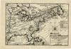
13970-1-map.tif
Carte de partie de la coste du Nouveau Biloxy : avec les isles des environs / Le Blond de la Tour (photocopy
Le Blond de la Tour, Pierre
Harrison County
https://da.mdah.ms.gov/series/maps/detail/191238
-
528-1-map.tif
Carte reduite des costes de la Louisiane et de la Floride : Dressee au Depost des cartes, plans, et journeaux
de la marine / par le S.
Bellin, ingenieur de la marine. No. 66.
https://da.mdah.ms.gov/series/maps/detail/191036
-
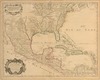
13633-1-map.tif
Carte du Mexique et de la Floride : des terres angloises et des Isles Antilles, du cours et des environs
de la riviere de Mississipi [sic] / dressee sur un grand nombre de memoires principalemt. sur ceux de
L'Isle, Guillaume de
https://da.mdah.ms.gov/series/maps/detail/191142
-
13933-01-map.tif
Le Canada, ou Nouvelle France: nouvelle angleterre et Nouvelle Yorck, l' Isle de Terre Neuve, la Louisiane
et le cours de la riviere de Misisipi / N. de Fer.
Fer, Nicolas de
https://da.mdah.ms.gov/series/maps/detail/191227
-
-
69320-map-01.tif
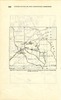
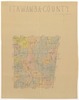
Humphreys County.
Humphreys County
https://da.mdah.ms.gov/series/maps/detail/191360
-
-
69332-map-01.tif
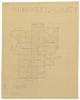
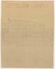
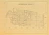
Jefferson County.
Jefferson County
https://da.mdah.ms.gov/series/maps/detail/191362
-
69335-map-01.tif
Jefferson County.
Jefferson County
https://da.mdah.ms.gov/series/maps/detail/191364
-
-
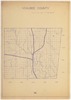
69724-map-01.tif
Wilkinson County.
Wilkinson County
https://da.mdah.ms.gov/series/maps/detail/191457
-
69728-map-01.tif
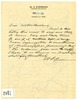
Washington County. The reverse contains a January 21, 1921, letter to Dunbar Rowland from W. A.
Washington County
https://da.mdah.ms.gov/series/maps/detail/191460
-
69728-map-02.tif
Washington County. The reverse contains a January 21, 1921, letter to Dunbar Rowland from W. A.
Washington County
https://da.mdah.ms.gov/series/maps/detail/191461
-
69734-01-map.tif
Tishomingo County / Joe Bell, former Secy of State.
Tishomingo County
https://da.mdah.ms.gov/series/maps/detail/191463
-
-
-
-
-
-
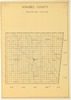
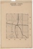
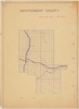
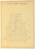
69759-map-01.tif
Montgomery County.
Montgomery County
https://da.mdah.ms.gov/series/maps/detail/191479
-
-
-
69775-map-01.tif
Lafayette County.
Lafayette County
https://da.mdah.ms.gov/series/maps/detail/191491
-
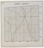
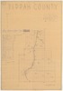
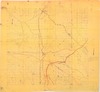
69321-map-01.tif
Issaquena County
Issaquena County
https://da.mdah.ms.gov/series/maps/detail/1061884
-
8032-1-map.tif
Partie meridionale de la Louisiane avec la Virginie / par Sr. D'Anville.
https://da.mdah.ms.gov/series/maps/detail/191039
-
14134-1-map.tif
Les Etats Unis de l'Amerique septentrionale, partie occidentale / par M.
Bonne, ingenieur hydrographe de la marine.
https://da.mdah.ms.gov/series/maps/detail/191294
-
13946_1_map.tif
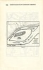
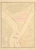
Tampa Bay to illustrate the landing of De Soto's Army as indicated in the present report.
From: The Final Report of the United States De Soto Expedition Commission, p. 344.
https://da.mdah.ms.gov/series/maps/detail/191230
-
8031-c1-map.tif
Carte de la Louisiane et du cours du Mississipi / dressee sur un grand nombre de memoires entrautres
[i.e. entr'autres] sur ceux de Mr. le Maire, par Guillaume de l'Isle.
L'Isle, Guillaume de
https://da.mdah.ms.gov/series/maps/detail/191038
-
13631-1-map.tif
Carte de la Louisiane et du cours du Mississipi /dressee sur un grand nombre de memoires entrautres
[i.e. entr'autres] sur ceux de Mr. le Maire, par Guillaume de l'Isle.
L'Isle, Guillaume de
https://da.mdah.ms.gov/series/maps/detail/191141
-
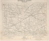
82424-01-map.tif
County highway maps (annotated), 1938-1996. Marion County map.
Marion County
https://da.mdah.ms.gov/series/maps/detail/191634
-
13954-map.tif
Reconquista del Fuerte de San Marcos de Apalache : por las tropas Espanolas al mando del tente.
https://da.mdah.ms.gov/series/maps/detail/191236
-
69307-map-01.tif
George County, Mississippi.
George County
https://da.mdah.ms.gov/series/maps/detail/191358
-
69344-map-01.tif
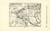
Hinds County, Mississippi / Richard I. Scott, del.
Hinds County
https://da.mdah.ms.gov/series/maps/detail/191368
-
69737-map-01.tif
Tippah County, Mississippi.
Tippah County
https://da.mdah.ms.gov/series/maps/detail/191465
-
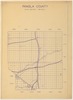
69748-1-map.tif
Pontotoc County, Mississippi / historians of Pontotoc County.
Pontotoc County
https://da.mdah.ms.gov/series/maps/detail/191472
-
69753-map-01.tif
Oktibbeha County, Mississippi / by John H.
Oktibbeha County
https://da.mdah.ms.gov/series/maps/detail/191475
-
69776-map-1.tif
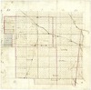
Bolivar County, T17R5W.
Bolivar County
https://da.mdah.ms.gov/series/maps/detail/191492
-
69779-map-01.tif
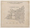
Claiborne County, Mississippi.
Claiborne County
https://da.mdah.ms.gov/series/maps/detail/191494
-
69723-map-01.tif
Winston County, Mississippi [map] / LaSueur.
Winston County
https://da.mdah.ms.gov/series/maps/detail/928318