Historical Maps
The Mississippi Department of Archives and History has cataloged over 2,500 maps in its "published information" collection. They include hand-drawn sketches of towns, localities, plantations, and battlefields, as well as published maps from the sixteenth through twenty-first centuries.
MDAH staff digitized over 600 paper maps for this online exhibit. The earliest is a triptych printed by the famous Dutch cartographer Abraham Ortelius in 1588, including La Florida, drawn by Geronimo Chaves. In his book The Southeast in Early Maps, William P. Cumming called La Florida "one of the half-dozen most important mother maps of southeastern North America." Several maps in the exhibit trace the history of Mississippi from early exploration through colonial expansion, the territorial period, and statehood. Others are hand-drawn plans and plats of towns, such as P. A. Van Dorn's original plan for the city of Jackson in 1822.
Many maps can also be found in other MDAH collections, such as government records and personal papers. One such example is included in this exhibit, the colorful map of the town of Washington, Mississippi, hand drawn by B. L. C. Wailes in the town's 1838 Minute Book. Maps that other state government agencies (especially the Mississippi Department of Transportation) have scanned to document work projects and then transferred to MDAH are not included here but can be accessed with other electronic government records.
Read MoreThe Mississippi Department of Archives and History has cataloged over 2,500 maps in its "published information" collection. They include hand-drawn sketches of towns, localities, plantations, and battlefields, as well as published maps from the sixteenth through twenty-first centuries.
MDAH staff digitized over 600 paper maps for this online exhibit. The earliest is a triptych printed by the famous Dutch cartographer Abraham Ortelius in 1588, including La Florida, drawn by Geronimo Chaves. In his book The Southeast in Early Maps, William P. Cumming called La Florida "one of the half-dozen most important mother maps of southeastern North America." Several maps in the exhibit trace the history of Mississippi from early exploration through colonial expansion, the territorial period, and statehood. Others are hand-drawn plans and plats of towns, such as P. A. Van Dorn's original plan for the city of Jackson in 1822.
Many maps can also be found in other MDAH collections, such as government records and personal papers. One such example is included in this exhibit, the colorful map of the town of Washington, Mississippi, hand drawn by B. L. C. Wailes in the town's 1838 Minute Book. Maps that other state government agencies (especially the Mississippi Department of Transportation) have scanned to document work projects and then transferred to MDAH are not included here but can be accessed with other electronic government records.
-
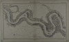
Mississippi River / published by the Mississippi River Commission, drawn by Edw. Molitor, sheet 11.
Date: 1882
Creator: Molitor, E.
Filename: 72487-11-map.tif
-
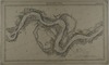
Mississippi River / published by the Mississippi River Commission, drawn by Edw. Molitor, sheet 12.
Date: 1882
Creator: Molitor, E.
Filename: 72487-12-map.tif
-
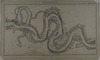
Mississippi River / published by the Mississippi River Commission, drawn by Edw. Molitor, sheet 13 [Rosedale, Miss. and Catfish Point, Beulah, Miss.].
Date: 1882
Creator: Molitor, E.
Filename: 72487-13-map.tif
-
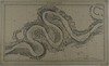
Mississippi River / published by the Mississippi River Commission, drawn by Edw. Molitor, sheet 14 [Greenville, Miss.].
Date: 1882
Creator: Molitor, E.
Filename: 72487-14-map.tif
-
Mississippi River / published by the Mississippi River Commission, drawn by Edw. Molitor, sheet 15.
Date: 1882
Creator: Molitor, E.
Filename: 72487-15-map.tif
-
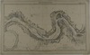
Mississippi River / published by the Mississippi River Commission, drawn by Edw. Molitor, sheet 16.
Date: 1882
Creator: Molitor, E.
Filename: 72487-16-map.tif
-
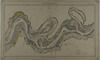
Mississippi River / published by the Mississippi River Commission, drawn by Edw. Molitor, sheet 17.
Date: 1882
Creator: Molitor, E.
Filename: 72487-17-map.tif
-
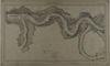
Mississippi River / published by the Mississippi River Commission, drawn by Edw. Molitor, sheet 18 [Vicksburg, Miss., Davis Island].
Date: 1882
Creator: Molitor, E.
Filename: 72487-18-map.tif
-
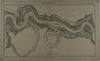
Mississippi River / published by the Mississippi River Commission, drawn by Edw. Molitor, sheet 19 [Grand Gulf and Rodney, Miss.].
Date: 1882
Creator: Molitor, E.
Filename: 72487-19-map.tif
-
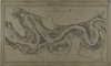
Mississippi River / published by the Mississippi River Commission, drawn by Edw. Molitor, sheet 20 [Natchez, Miss.].
Date: 1882
Creator: Molitor, E.
Filename: 72487-20-map.tif
-
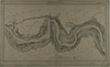
Mississippi River / published by the Mississippi River Commission, drawn by Edw. Molitor, sheet 21.
Date: 1882
Creator: Molitor, E.
Filename: 72487-21-map.tif
-
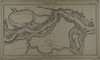
Mississippi River / published by the Mississippi River Commission, drawn by Edw. Molitor, sheet 22 [Miss.-La. boundary].
Date: 1882
Creator: Molitor, E.
Filename: 72487-22-map.tif
-
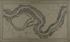
Mississippi River / published by the Mississippi River Commission, drawn by Edw. Molitor, sheet 23.
Date: 1882
Creator: Molitor, E.
Filename: 72487-23-map.tif
-
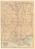
Asher and Adams' Louisiana and Mississippi.
Date: 1871
Creator: Asher & Adams
Filename: 72488-c1-map.tif
-
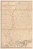
Post route map of the states of Alabama and Mississippi, with adjacent parts of Florida, Georgia, Tennessee, Arkansas and Louisiana: showing post offices, with the intermediate distances between them....
Date: 1883
Creator: United States Post Office Department
Filename: 72489-01-map.tif
-
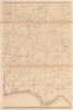
Post route map of the states of Alabama and Mississippi, with adjacent parts of Florida, Georgia, Tennessee, Arkansas and Louisiana: showing post offices, with the intermediate distances between them....
Date: 1883
Creator: United States Post Office Department
Filename: 72489-02-map.tif
-
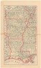
New rail road and county map of Arkansas, Louisiana & Mississippi / George F. Cram Co. On verso: Missouri.
Date: 1883
Filename: 72490-1-map.tif
-
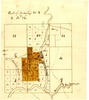
Part of Township 20, R26, Leflore County: showing Yallabusha (sic) River, Charley's Trail, Patacocone Creek.
Date: 1884
Filename: 72492-map.tif
-
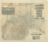
Exposition map of the city of New Orleans / F.F. Hansell, law bookseller and dealer in stationery.
Date: 1884
Filename: 72493-map-01.tif
-
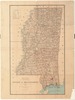
State of Mississippi / compiled from the official records of the General Land Office and other sources, Dept. of Interior, G.P. Strum, principal draughtsman.
Date: 1885
Creator: United States Department of the Interior
Filename: 72494-map-01.tif
-
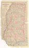
Gray's new map of Mississippi / by Frank A. Gray.
Date: 1886
Creator: Gray, Frank A.
Filename: 72495-map-01.tif
-
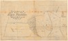
Tract of land in the south western portion of Elgin Plantation / Chs. W. Babbit.
Date: 1888
Creator: Babbitt, C. W. (Chs. W.)
Filename: 72496-map.tif
-
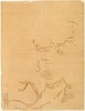
-
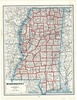
-
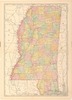
Mississippi. From: Rand, McNally & Company's Indexed Atlas of the World, pages 318-319.
Date: 1898
Filename: 72500-map-01.tif
-
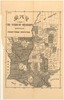
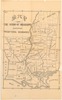
Map of the Synod of Mississippi showing Presbyterian destitution.
Date: 1892
Filename: 72502-c1-map.tif
-
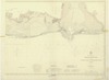
Mobile entrance and eastern part of Mississippi Sound, Alabama / U.S. Coast and Geodetic Survey, Sept., 1896.
Date: 1896
Creator: U.S. Coast and Geodetic Survey
Filename: 72503-map-01.tif
-
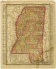
Mississippi / Rand, McNally & Co., page 33.
Date: 1895
Creator: Rand McNally and Company
Filename: 72504-1-map.tif
-
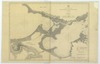
Lakes Borgne and Pontchartrain, Louisiana / U.S. Coast and Geodetic Survey.
Date: 1900
Creator: U.S. Coast and Geodetic Survey
Filename: 72508-map-01.tif
-
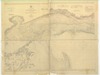
Mississippi Sound: western part : from Round I. to St. Joseph I. / U.S. Coast and Geodetic Survey.
Date: 1900
Creator: U.S. Coast and Geodetic Survey
Filename: 72509-map-01.tif