
Historical Maps
The Mississippi Department of Archives and History has cataloged over 2,500 maps in its "published information" collection. They include hand-drawn sketches of towns, localities, plantations, and battlefields, as well as published maps from the sixteenth through twenty-first centuries.
MDAH staff digitized over 600 paper maps for this online exhibit. The earliest is a triptych printed by the famous Dutch cartographer Abraham Ortelius in 1588, including La Florida, drawn by Geronimo Chaves. In his book The Southeast in Early Maps, William P. Cumming called La Florida "one of the half-dozen most important mother maps of southeastern North America." Several maps in the exhibit trace the history of Mississippi from early exploration through colonial expansion, the territorial period, and statehood. Others are hand-drawn plans and plats of towns, such as P. A. Van Dorn's original plan for the city of Jackson in 1822.
Many maps can also be found in other MDAH collections, such as government records and personal papers. One such example is included in this exhibit, the colorful map of the town of Washington, Mississippi, hand drawn by B. L. C. Wailes in the town's 1838 Minute Book. Maps that other state government agencies (especially the Mississippi Department of Transportation) have scanned to document work projects and then transferred to MDAH are not included here but can be accessed with other electronic government records.
Read MoreThe Mississippi Department of Archives and History has cataloged over 2,500 maps in its "published information" collection. They include hand-drawn sketches of towns, localities, plantations, and battlefields, as well as published maps from the sixteenth through twenty-first centuries.
MDAH staff digitized over 600 paper maps for this online exhibit. The earliest is a triptych printed by the famous Dutch cartographer Abraham Ortelius in 1588, including La Florida, drawn by Geronimo Chaves. In his book The Southeast in Early Maps, William P. Cumming called La Florida "one of the half-dozen most important mother maps of southeastern North America." Several maps in the exhibit trace the history of Mississippi from early exploration through colonial expansion, the territorial period, and statehood. Others are hand-drawn plans and plats of towns, such as P. A. Van Dorn's original plan for the city of Jackson in 1822.
Many maps can also be found in other MDAH collections, such as government records and personal papers. One such example is included in this exhibit, the colorful map of the town of Washington, Mississippi, hand drawn by B. L. C. Wailes in the town's 1838 Minute Book. Maps that other state government agencies (especially the Mississippi Department of Transportation) have scanned to document work projects and then transferred to MDAH are not included here but can be accessed with other electronic government records.
-
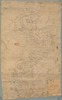
Plot of Vicksburg and Natchez Districts for leasing abandoned plantations.
Date: 1864
Filename: 104201-01-map.tif
-
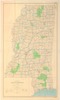
State of Mississippi : base map with highways and contours / compiled, edited, and published by the Geological Survey.
Date: 1972
Creator: Geological Survey (U.S.)
Filename: 115070-1-map.tif
-

Map of the city of Jackson : with surveyor's references & distances / published by James Smith, ca. 1908; date of situation: April 1st, 1845; "Taken from the original map in the Secretary of State's o...
Date: 1908
Creator: Smith, James
Filename: 116506-map-1.tif
-
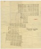
Belhaven Heights : Jackson, Miss.
Filename: 116693-map-1.tif
-
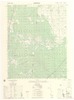
Porterville / prepared by the U.S. Geological Survey for publication by the Defense Mapping Agency Hydrographic/Topographic Center.
Date: 1989
Creator: Geological Survey (U.S.)
Filename: 116817-map-01.tif
-
Hurley / prepared by the U.S. Geological Survey for publication by the Defense Mapping Agency Hydrographic/Topographic Center.
Date: 1985
Creator: Geological Survey (U.S.)
Filename: 116818-map-01.tif
-
West Point / prepared by the Army Map Service (AJEE), Corps of Engineers, U.S. Army.
Date: 1963
Creator: United States Army Map Service
Filename: 117982-map-01.tif
-
Natchez / prepared by the Army Map Service (AJAM), Corps of Engineers, U.S. Army.
Date: 1959
Creator: United States Army Map Service
Filename: 117983-map-01.tif
-
Hattiesburg / prepared by the Army Map Service (AJEE), Corps of Engineers, U.S. Army.
Date: 1965
Creator: United States Army Map Service
Filename: 117984-map-01.tif
-
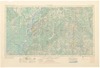
Natchez / prepared by the Army Map Service (AJAM), Corps of Engineers, U.S. Army.
Date: 1955
Creator: United States Army Map Service
Filename: 117985-map-01.tif
-
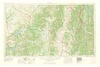
Tupelo / prepared by the Army Map Service (TVSX), Corps of Engineers, U.S. Army.
Date: 1958
Creator: United States Army Map Service
Filename: 117987-map-01.tif
-
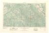
Meridian / prepared by the Army Map Service (AJEE), Corps of Engineers, U.S. Army.
Date: 1957
Creator: United States Army Map Service
Filename: 117988-map-01.tif
-
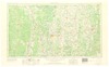
Greenwood / prepared by the Army Map Service (AMTV), Corps of Engineers, U.S. Army.
Date: 1966
Creator: United States Army Map Service
Filename: 117989-map-01.tif
-
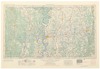
Greenwood / prepared by the Army Map Service, Corps of Engineers, U.S. Army, side 1.
Date: 1954
Creator: United States Army Map Service
Filename: 117990-map-01.tif
-
Greenwood / prepared by the Army Map Service, Corps of Engineers, U.S. Army, side 2.
Date: 1954
Creator: United States Army Map Service
Filename: 117990-map-02.tif
-
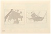
Fort Mims, side 1.
Filename: 119718-map-01.tif
-
Fort Mims, side 2.
Filename: 119718-map-02.tif
-
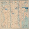
Panorama of the Mississippi Valley: and its fortifications / eng. by F.W. Boell.
Date: 1863
Creator: Magnus, Charles
Filename: 1224-01-map.tif
-
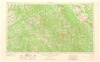
Meridian / prepared by the Army Map Service (AJEE), Corps of Engineers, U.S. Army.
Date: 1965
Creator: United States Army Map Service
Filename: 124042-map-01.tif
-
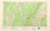
Jackson / prepared by the Army Map Service (AMTV), Corps of Engineers, U.S. Army.
Date: 1962
Creator: United States Army Map Service
Filename: 124459-map-01.tif
-
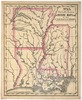
Mitchell's series of outline maps for the use of academies & schools. No. 13.
Date: 1841
Creator: Mitchell, S. Augustus
Filename: 124967-map-01.tif
-
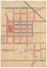
A plan of the town of Clinton and adjacent lands / drawn from G. Fitz's original plot by Nabors & Comfort, side 1.
Date: 1856
Creator: Nabors & Comfort
Filename: 126290-map-01.tif
-
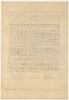
A plan of the town of Clinton and adjacent lands / drawn from G. Fitz's original plot by Nabors & Comfort, side 2.
Date: 1856
Creator: Nabors & Comfort
Filename: 126290-map-02.tif
-
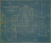
Plat map of subdivision showing townships, ranges, sections, and acreage of properties belonging to Walter Bracey, Peter Bracey, Frederick L. Cornwell, C.K. Dunn, Jules Lewis, Emma Catchings.
Date: 1928
Creator: Casey, Jules A.
Filename: 126344-map-1.tif
-
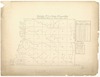
Township no. 2 in range no. 5 and 6, west : land district east of Pearl River, M.T. / Tho Freeman.
Date: 1807
Creator: Freeman, Thomas
Filename: 126655-map-01.tif
-
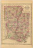
Shows states, counties, towns and cities, railroads, rivers and streams. Covers: Part of Alabama, Tennessee, Missouri, Texas, and Indian territory. Relief shown by hachures.
Date: 1866
Creator: Johnson and Ward
Filename: 132396-map-01.tif
-
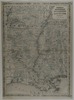
Johnson's Arkansas, Mississippi and Louisiana / by Johnson and Ward. From Johnson's Family World Atlas, version 8.
Date: 1864
Filename: 132681-1-map.tif
-
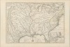
Carte de la Louisiane et du cours du Mississipi /dressee sur un grand nombre de memoires entrautres [i.e. entr'autres] sur ceux de Mr. le Maire, par Guillaume de l'Isle.
Date: 1718
Creator: L'Isle, Guillaume de
Filename: 13631-1-map.tif
-
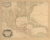
Carte du Mexique et de la Floride : des terres angloises et des Isles Antilles, du cours et des environs de la riviere de Mississipi [sic] / dressee sur un grand nombre de memoires principalemt. sur c...
Date: 1703
Creator: L'Isle, Guillaume de
Filename: 13633-1-map.tif
-
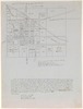
A plan of Clinton and adjacent lands /drawn from G. Fitz's original plot by Hilley Moseley Jan. 17, 1856; transcribed by J.D. Coleman 1883; copied by Elsie Timberlake July 24, 1913.
Date: 1913
Creator: Fitz, Gideon
Filename: 13822-map.tif
-
Northern Mississippi and Alabama / U.S. Coast Survey.
Date: 1864
Creator: United States Coast Survey
Filename: 13829-01-map.tif
-
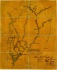
Map of the approaches to Vicksburg by Union forces / Edward R. Taylor, Capt. & Chief Engineer.
Date: 1863
Filename: 13830-map.tif