Historical Maps
The Mississippi Department of Archives and History has cataloged over 2,500 maps in its "published information" collection. They include hand-drawn sketches of towns, localities, plantations, and battlefields, as well as published maps from the sixteenth through twenty-first centuries.
MDAH staff digitized over 600 paper maps for this online exhibit. The earliest is a triptych printed by the famous Dutch cartographer Abraham Ortelius in 1588, including La Florida, drawn by Geronimo Chaves. In his book The Southeast in Early Maps, William P. Cumming called La Florida "one of the half-dozen most important mother maps of southeastern North America." Several maps in the exhibit trace the history of Mississippi from early exploration through colonial expansion, the territorial period, and statehood. Others are hand-drawn plans and plats of towns, such as P. A. Van Dorn's original plan for the city of Jackson in 1822.
Many maps can also be found in other MDAH collections, such as government records and personal papers. One such example is included in this exhibit, the colorful map of the town of Washington, Mississippi, hand drawn by B. L. C. Wailes in the town's 1838 Minute Book. Maps that other state government agencies (especially the Mississippi Department of Transportation) have scanned to document work projects and then transferred to MDAH are not included here but can be accessed with other electronic government records.
Read MoreThe Mississippi Department of Archives and History has cataloged over 2,500 maps in its "published information" collection. They include hand-drawn sketches of towns, localities, plantations, and battlefields, as well as published maps from the sixteenth through twenty-first centuries.
MDAH staff digitized over 600 paper maps for this online exhibit. The earliest is a triptych printed by the famous Dutch cartographer Abraham Ortelius in 1588, including La Florida, drawn by Geronimo Chaves. In his book The Southeast in Early Maps, William P. Cumming called La Florida "one of the half-dozen most important mother maps of southeastern North America." Several maps in the exhibit trace the history of Mississippi from early exploration through colonial expansion, the territorial period, and statehood. Others are hand-drawn plans and plats of towns, such as P. A. Van Dorn's original plan for the city of Jackson in 1822.
Many maps can also be found in other MDAH collections, such as government records and personal papers. One such example is included in this exhibit, the colorful map of the town of Washington, Mississippi, hand drawn by B. L. C. Wailes in the town's 1838 Minute Book. Maps that other state government agencies (especially the Mississippi Department of Transportation) have scanned to document work projects and then transferred to MDAH are not included here but can be accessed with other electronic government records.
-
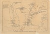
The territory between the Chattahoochee and Mississippi Rivers / Baron de Crenay. Appears in: Hamilton's Colonial Mobile. From: Bureau of American Ethnology, Bulletin 73, Plate 5: Early History of the...
Date: 1922
Creator: Crenay, Baron de
Filename: 13990-1-map.tif
-
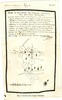
Plan et scituation des villages Tchikachas / DeBatz. From: Mississippi Provincial Archives, 1729-1740. Original version: Societe Des Americanistes de Paris.-[Paris : s.n.], 1921. Planche I (photocopy)
Date: 1921
Creator: Batz, Alexandre de
Filename: 13993-1-map.tif
-
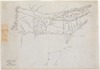
A map of the country adjacent to the River Misisipi /copied by A[lexander] S[potswood] from the original draught of [Price] Hughes.
Date: 1720
Creator: Spotswood, Alexander
Filename: 14003-map.tif
-
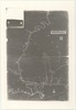
Carte des environs du Mississipi / [by Guillaume de L'Isle, given by M. d'Iberville in 1701] (negative photostat).
Date: 1927-06-30
Creator: L'Isle, Guillaume de
Filename: 14004-map.tif
-
-
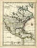
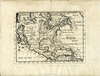
L'Amerique Septentrionale / [George Louis Le Rouge].
Date: 1748
Creator: Le Rouge, George Louis
Filename: 14006-01-map.tif
-
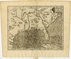
Florida et Apalche. From: Descriptionis Ptolemaicae augmentum / C. Wytfliet. Louvain : J. Bogardi, 1597.
Date: 1597
Creator: Wytfliet, Corneille
Filename: 14011-1-map.tif
-
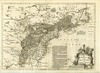
A map of the British and French settlements in North America / J. Lodge, sculptor. From: The Scot's Magazine, 1755.
Date: 1755
Creator: Lodge, John
Filename: 14021-01-map.tif
-
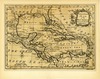
A new & correct map of the West Indies / drawn from the best authorities J. Gibson, Sculpt.
Date: 1762
Creator: Gibson, J. (John)
Filename: 14026-1-map.tif
-
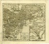
An accurate map of the British Empire in Nth. America : as settled by the Preliminaries in 1762 / [John Gibson]. From: The Gentleman's Magazine, London, 1762.
Date: 1762
Creator: Gibson, J. (John)
Filename: 14027-01-map.tif
-
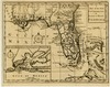
A map of the new governments of East & West Florida / John Gibson.
Date: 1763
Creator: Gibson, J. (John)
Filename: 14028-01-map.tif
-
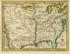
Louisiana, Virginia, Carolina. From: Gentleman's Magazine, London.
Date: 1763
Creator: Gibson, J. (John)
Filename: 14031-01-map.tif
-
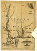
A map of the country comprised in the state of Mississippi : as known in the year 1764 / by Eman. Bowen, Geographer. Drawn by B.L.C. Wailes. From: Emanuel Bowen's A New Map of Georgia, with Parts of C...
Date: 1864
Creator: Wailes, Benjamin L. C. (Benjamin Leonard Covington)
Filename: 14033-map.tif
-
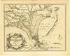
A new map of the river Mississipi : from the sea to Bayagoulas / by Thomas Kitchin. From: London Magazine, 1761.
Date: 1761
Creator: Kitchin, Thomas
Filename: 14044-01-map.tif
-
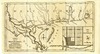
A map of part of West Florida : from Pensacola to the mouth of the Iberville River, with a view to shew the proper spot for a settlement on the Mississipi / J. Lodge sculp. From: Gentleman's Magazine,...
Date: 1772
Creator: Lodge, John
Filename: 14045-1-map.tif
-
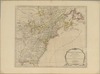
North America / from the French of Mr. D'Anville, improved with the English surveys made since the peace.
Date: 1775
Creator: Anville, Jean Baptiste Bourguignon d'
Filename: 14051-01-map.tif
-
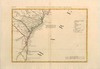
Parte orientale della Florida, della Georgia, E. Carolina Meridionale / [Antonio Zatta]. Appears in: Atlante Novissimo, Fogl. VI.
Date: 1778
Creator: Zatta, Antonio
Filename: 14057-01-map.tif
-
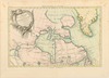
Partie de L'Amerique Septentrionale, qui comprend le Canada, la Louisiane, le Labrado, le Groenland, la Nouvelle Angleterre, la Floride &c : projettee et assujettie aux observations / par Mr. Bonne.,...
Date: 1776
Creator: Bonne, Rigobert
Filename: 14059-1-map.tif
-
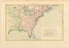
Partie de L'Amerique Septentrionale, qui comprend le Canada, la Louisiane, le Labrado, le Groenland, la Nouvelle Angleterre, la Floride &c : projettee et assujettie aux observations / par Mr. Bonne.,...
Date: 1776
Creator: Bonne, Rigobert
Filename: 14059-2-map.tif
-
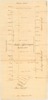
Plan of land granted to Phillip Affleck / survey and laid out by Elias Durnford.
Date: 1778
Creator: Durnford, Elias Walker
Filename: 14065-1-map.tif
-
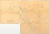
A plan of the Lakes Ponchartrain, and Maurepas, and the river Ibberville : and also of the river Mississippi from its mouth to the river Yazou. - A distance of 450 miles / by Tho. Hutchins, side 1.
Date: 1784
Creator: Hutchins, Thomas
Filename: 14070-map-01.tif
-
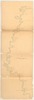
A plan of the Lakes Ponchartrain, and Maurepas, and the river Ibberville: and also of the river Mississippi from its mouth to the river Yazou. - A distance of 450 miles / by Tho. Hutchins, side 2.
Date: 1784
Creator: Hutchins, Thomas
Filename: 14070-map-02.tif
-
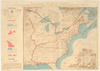
A new and correct map of the United States of North America : layd down from the latest observations and best authorities agreeable to the peace of 1783. Humbly inscribed to his excellency the Governo...
Date: 1938
Creator: Buell, Abel
Filename: 14072-map-01.tif
-
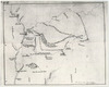
Indian cessions in upper Mississippi / by Baron de Carondelet (photocopy).
Date: 1792
Creator: Carondelet, Francois Louis Hector Baron de
Filename: 14081-map-01.tif
-
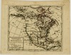
Amerique septentrionale / dressee d'apres les decouvertes du Cap? Cook, par Lamarche, geographe.
Date: 1795
Creator: Lamarche
Filename: 14082-1-map.tif
-
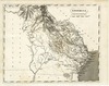
Georgia / by Samuel Lewis, D. Fairman [sculptor]. Appears in: A new and elegant general atlas, drawn by Arrowsmith and Lewis.
Date: 1804
Creator: Lewis, Samuel
Filename: 14094-01-map.tif
-
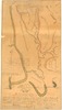
Map of a tract of land containing 5120 acres, granted by the mingoes and chiefs of the Chaktaw nation of Indians, in a treaty concluded at Mount Dexter on the 16th day of November in the year 1805 / b...
Date: 1809
Creator: Wailes, Levin
Filename: 14095-map.tif
-
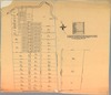
-
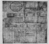
A plan of the town of Kingston: taken from the original survey, Apr. 1815 (photocopy).
Date: 1815
Filename: 14098-1-map.tif
-
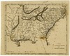
The southern states and Mississippi Territory.
Date: 1816
Creator: Mathew Carey & Son
Filename: 14100-1-map.tif
-
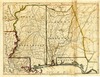
State of Mississippi and Alabama Territory.
Date: 1817
Creator: Darby, William
Filename: 14101-1-map.tif