
Mississippi Gulf Coast Aerial Photographs, August 30, 2005
These are two hundred and thirty-two (232) grayscale scans produced by MDAH from two hundred and thirty-one (231) aerial photographs taken August 30, 2005, along Mississippi's Gulf Coast and a photocopy of the flight order map that documents the flight paths taken during this photography mission. The map includes details like flight numbers, directions, and photograph numbers, which can be used to identify the objects captured in the images. The Mississippi Department of Transportation (MDOT) ordered the aerial photographs to plan highway repairs following Hurricane Katrina. The original photographs are part of Series 152: Department of Transportation Aerial Photographs, 1936-2005. The photocopied map is from MDOT Series 2625: Aerial Photograph Indexes and Flight Order Maps, 1960-2006.
Read MoreThese are two hundred and thirty-two (232) grayscale scans produced by MDAH from two hundred and thirty-one (231) aerial photographs taken August 30, 2005, along Mississippi's Gulf Coast and a photocopy of the flight order map that documents the flight paths taken during this photography mission. The map includes details like flight numbers, directions, and photograph numbers, which can be used to identify the objects captured in the images. The Mississippi Department of Transportation (MDOT) ordered the aerial photographs to plan highway repairs following Hurricane Katrina. The original photographs are part of Series 152: Department of Transportation Aerial Photographs, 1936-2005. The photocopied map is from MDOT Series 2625: Aerial Photograph Indexes and Flight Order Maps, 1960-2006.
-
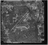
Aerial photograph of Mississippi Gulf Coast showing damage from Hurricane Katrina (MDOT job order 06-01). Flight 2, photo 77. 302434.1 North, 0890415.8 West, Altitude 3710, Direction 271.
Date: 2005-08-30
Filename: 152-flight02-077.tif
-
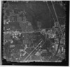
Aerial photograph of Mississippi Gulf Coast showing damage from Hurricane Katrina (MDOT job order 06-01). Flight 2, photo 78. 302435.7 North, 0890537.6 West, Altitude 3710, Direction 272.
Date: 2005-08-30
Filename: 152-flight02-078.tif
-
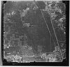
Aerial photograph of Mississippi Gulf Coast showing damage from Hurricane Katrina (MDOT job order 06-01). Flight 2, photo 79. 302436.4 North, 0890659.9 West, Altitude 3710, Direction 270.
Date: 2005-08-30
Filename: 152-flight02-079.tif
-
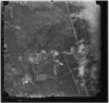
Aerial photograph of Mississippi Gulf Coast showing damage from Hurricane Katrina (MDOT job order 06-01). Flight 2, photo 80. 302436.9 North, 0890821.6 West, Altitude 3710, Direction 271.
Date: 2005-08-30
Filename: 152-flight02-080.tif
-
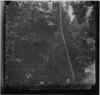
Aerial photograph of Mississippi Gulf Coast showing damage from Hurricane Katrina (MDOT job order 06-01). Flight 2, photo 81. 302437.7 North, 0890943.7 West, Altitude 3720, Direction 270.
Date: 2005-08-30
Filename: 152-flight02-081.tif
-
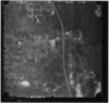
Aerial photograph of Mississippi Gulf Coast showing damage from Hurricane Katrina (MDOT job order 06-01). Flight 2, photo 82. 302437.5 North, 0891105.9 West, Altitude 3720, Direction 269.
Date: 2005-08-30
Filename: 152-flight02-082.tif
-
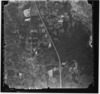
Aerial photograph of Mississippi Gulf Coast showing damage from Hurricane Katrina (MDOT job order 06-01). Flight 2, photo 83. 302437.0 North, 0891227.8 West, Altitude 3700, Direction 270.
Date: 2005-08-30
Filename: 152-flight02-083.tif
-
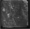
Aerial photograph of Mississippi Gulf Coast showing damage from Hurricane Katrina (MDOT job order 06-01). Flight 2, photo 84. 302436.6 North, 0891349.6 West, Altitude 3720, Direction 270.
Date: 2005-08-30
Filename: 152-flight02-084.tif
-
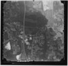
Aerial photograph of Mississippi Gulf Coast showing damage from Hurricane Katrina (MDOT job order 06-01). Flight 2, photo 85. 302437.3 North, 0891511.8 West, Altitude 3720, Direction 270.
Date: 2005-08-30
Filename: 152-flight02-085.tif
-
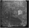
Aerial photograph of Mississippi Gulf Coast showing damage from Hurricane Katrina (MDOT job order 06-01). Flight 2, photo 86. 302436.9 North, 0891633.9 West, Altitude 3730, Direction 270.
Date: 2005-08-30
Filename: 152-flight02-086.tif
-
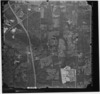
Aerial photograph of Mississippi Gulf Coast showing damage from Hurricane Katrina (MDOT job order 06-01). Flight 2, photo 87. 302436.2 North, 0891755.9 West, Altitude 3730, Direction 270.
Date: 2005-08-30
Filename: 152-flight02-087.tif
-
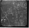
Aerial photograph of Mississippi Gulf Coast showing damage from Hurricane Katrina (MDOT job order 06-01). Flight 2, photo 88. 302436.5 North, 0891917.7 West, Altitude 3730, Direction 272.
Date: 2005-08-30
Filename: 152-flight02-088.tif
-
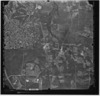
Aerial photograph of Mississippi Gulf Coast showing damage from Hurricane Katrina (MDOT job order 06-01). Flight 2, photo 89. 302437.7 North, 0892039.9 West, Altitude 3730, Direction 269.
Date: 2005-08-30
Filename: 152-flight02-089.tif
-
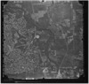
Aerial photograph of Mississippi Gulf Coast showing damage from Hurricane Katrina (MDOT job order 06-01). Flight 2, photo 90. 302435.9 North, 0892201.8 West, Altitude 3730, Direction 270.
Date: 2005-08-30
Filename: 152-flight02-090.tif
-
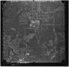
Aerial photograph of Mississippi Gulf Coast showing damage from Hurricane Katrina (MDOT job order 06-01). Flight 2, photo 91. 302436.8 North, 0892323.9 West, Altitude 3730, Direction 270.
Date: 2005-08-30
Filename: 152-flight02-091.tif
-
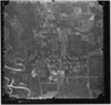
Aerial photograph of Mississippi Gulf Coast showing damage from Hurricane Katrina (MDOT job order 06-01). Flight 2, photo 92. 302436.0 North, 0892445.9 West, Altitude 3730, Direction 269.
Date: 2005-08-30
Filename: 152-flight02-092.tif
-
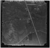
Aerial photograph of Mississippi Gulf Coast showing damage from Hurricane Katrina (MDOT job order 06-01). Flight 3, photo 1. 302224.4 North, 0892444.9 West, Altitude 3720, Direction 90.
Date: 2005-08-30
Filename: 152-flight03-001.tif
-
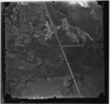
Aerial photograph of Mississippi Gulf Coast showing damage from Hurricane Katrina (MDOT job order 06-01). Flight 3, photo 2. 302225.1 North, 0892322.8 West, Altitude 3710, Direction 90.
Date: 2005-08-30
Filename: 152-flight03-002.tif
-
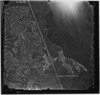
Aerial photograph of Mississippi Gulf Coast showing damage from Hurricane Katrina (MDOT job order 06-01). Flight 3, photo 3. 302225.9 North, 0892200.9 West, Altitude 3710, Direction 90.
Date: 2005-08-30
Filename: 152-flight03-003.tif
-
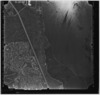
Aerial photograph of Mississippi Gulf Coast showing damage from Hurricane Katrina (MDOT job order 06-01). Flight 3, photo 4. 302225.1 North, 0892038.7 West, Altitude 3710, Direction 91.
Date: 2005-08-30
Filename: 152-flight03-004.tif
-
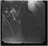
Aerial photograph of Mississippi Gulf Coast showing damage from Hurricane Katrina (MDOT job order 06-01). Flight 3, photo 5. 302223.9 North, 0891916.6 West, Altitude 3710, Direction 91.
Date: 2005-08-30
Filename: 152-flight03-005.tif
-
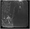
Aerial photograph of Mississippi Gulf Coast showing damage from Hurricane Katrina (MDOT job order 06-01). Flight 3, photo 6. 302223.5 North, 0891754.8 West, Altitude 3700, Direction 90.
Date: 2005-08-30
Filename: 152-flight03-006.tif
-
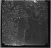
Aerial photograph of Mississippi Gulf Coast showing damage from Hurricane Katrina (MDOT job order 06-01). Flight 3, photo 7. 302223.5 North, 0891633.0 West, Altitude 3690, Direction 90.
Date: 2005-08-30
Filename: 152-flight03-007.tif
-
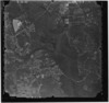
Aerial photograph of Mississippi Gulf Coast showing damage from Hurricane Katrina (MDOT job order 06-01). Flight 3, photo 8. 302223.6 North, 0891511.1 West, Altitude 3690, Direction 90.
Date: 2005-08-30
Filename: 152-flight03-008.tif
-
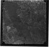
Aerial photograph of Mississippi Gulf Coast showing damage from Hurricane Katrina (MDOT job order 06-01). Flight 3, photo 9. 302224.4 North, 0891349.0 West, Altitude 3680, Direction 89.
Date: 2005-08-30
Filename: 152-flight03-009.tif
-
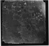
Aerial photograph of Mississippi Gulf Coast showing damage from Hurricane Katrina (MDOT job order 06-01). Flight 3, photo 10. 302225.9 North, 0891226.8 West, Altitude 3660, Direction 89.
Date: 2005-08-30
Filename: 152-flight03-010.tif
-
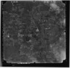
Aerial photograph of Mississippi Gulf Coast showing damage from Hurricane Katrina (MDOT job order 06-01). Flight 3, photo 11. 302227.4 North, 0891105.1 West, Altitude 3660, Direction 89.
Date: 2005-08-30
Filename: 152-flight03-011.tif
-
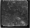
Aerial photograph of Mississippi Gulf Coast showing damage from Hurricane Katrina (MDOT job order 06-01). Flight 3, photo 12. 302228.0 North, 0890942.9 West, Altitude 3670, Direction 90.
Date: 2005-08-30
Filename: 152-flight03-012.tif
-
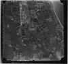
Aerial photograph of Mississippi Gulf Coast showing damage from Hurricane Katrina (MDOT job order 06-01). Flight 3, photo 13. 302226.9 North, 0890820.8 West, Altitude 3670, Direction 91.
Date: 2005-08-30
Filename: 152-flight03-013.tif
-
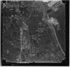
Aerial photograph of Mississippi Gulf Coast showing damage from Hurricane Katrina (MDOT job order 06-01). Flight 3, photo 14. 302225.9 North, 0890659.0 West, Altitude 3660, Direction 91.
Date: 2005-08-30
Filename: 152-flight03-014.tif
-
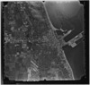
Aerial photograph of Mississippi Gulf Coast showing damage from Hurricane Katrina (MDOT job order 06-01). Flight 3, photo 15. 302226.3 North, 0890537.0 West, Altitude 3650, Direction 89.
Date: 2005-08-30
Filename: 152-flight03-015.tif
-
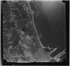
Aerial photograph of Mississippi Gulf Coast showing damage from Hurricane Katrina (MDOT job order 06-01). Flight 3, photo 16. 302227.6 North, 0890415.2 West, Altitude 3660, Direction 89.
Date: 2005-08-30
Filename: 152-flight03-016.tif